
Satellite Image Chapman Glacier
Satellite image Chapman Glacier in Nunavut Territory, Canada shows how satellite images support and facilitate scientific research activities at the landscape and regional scales. The availability of satellite imagery can provide spatial resolutions of up to 30 centimeters for analysis of glacier assessment and monitoring. Moreover, multispectral bands can provide an increased spectral resolution that can be used to analyze further and classify environmental conditions, land cover, and change detection and how the environment is impacted by these conditions.
Satellite image data is expected to contribute to a wide array of global climate change-related application areas for vegetation and ecosystem dynamics, hazard, and disaster monitoring, assessment, emergency management, land surface climatology, hydrology, and land cover change.
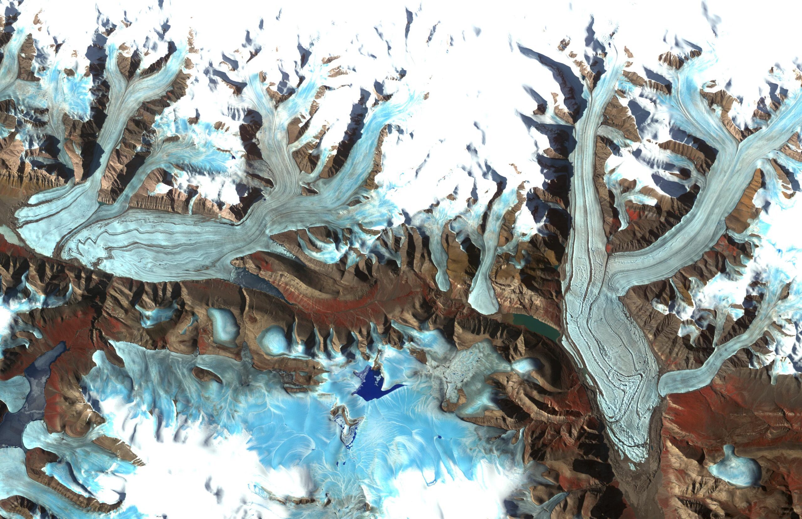
Image copyright © Caltech/JPL