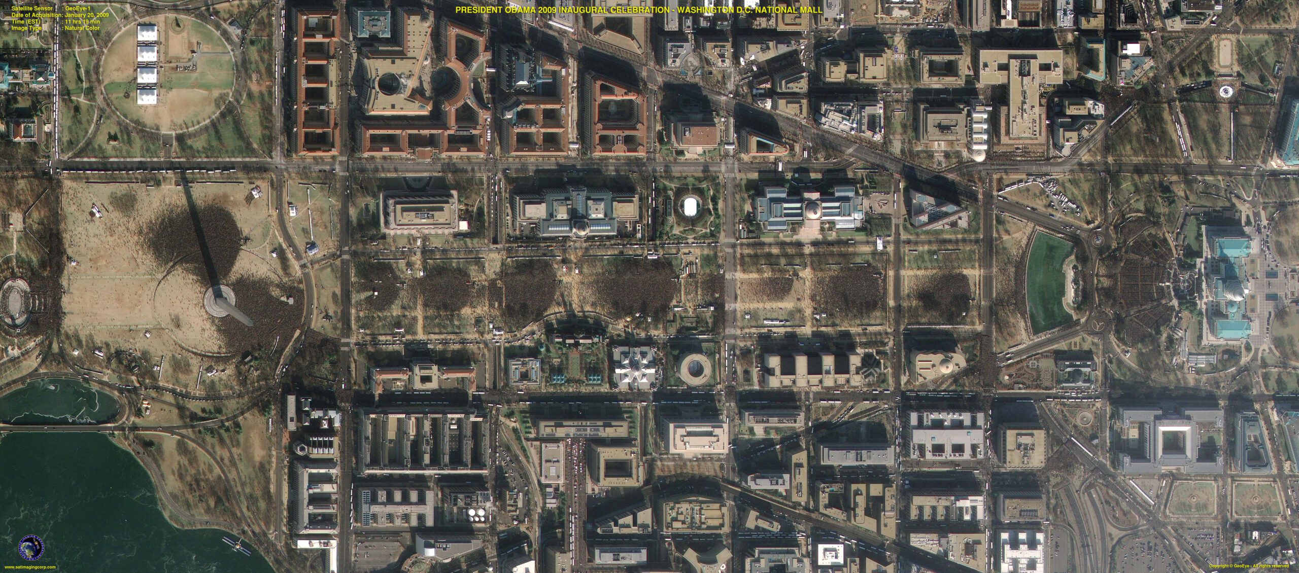
Satellite Image President Obama’s Inauguration
During the inauguration of President Barack Obama on Capitol Hill on Tuesday, January 20th, 2009 at 11:19 Hrs (EST), the GeoEye-1 satellite acquired a 0.41m natural-color satellite image marking this historic event identifying the large crowd of supporters. Satellite Imaging Corporation will carry this satellite image on its website for many to view and enjoy.
Satellite Imaging Corporation (SIC), an official Value Added Reseller (VAR) of GeoEye satellite imaging products and services is announcing that GeoEye programmed the new GeoEye-1 high-resolution earth imaging satellite, traveling at an altitude of 423 miles from north to south along the eastern seaboard of the United States at 17,000 mph or about four miles per second, to acquire a 0.41m resolution satellite image over Capitol Hill, Washington D.C. during the inauguration of President Barack Obama. However, due to current U.S. licensing restrictions, the imagery is re-sampled to a half-meter (0.5m) ground resolution. GeoEye will release the GeoEye-1 Satellite sensor for commercial tasking orders on February 5, 2009. GeoEye and Satellite Imaging Corporation will begin accepting orders for Mono and Stereo GeoEye-1 satellite imaging data products on that date.
Image copyright © MAXAR- All rights reserved.


