
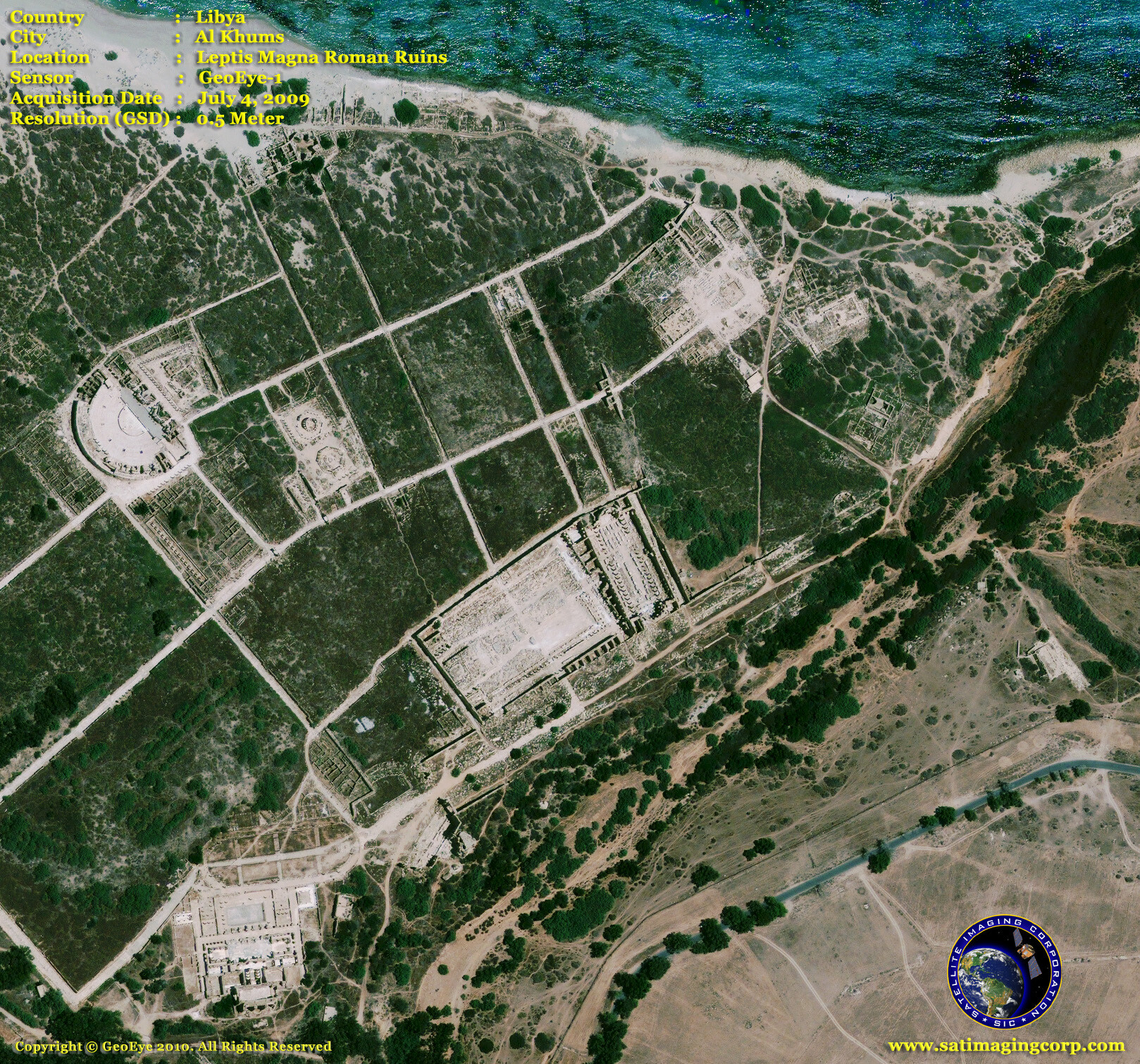
Satellite Image Leptis Magna Roman Ruins
Satellite images and GIS have become increasingly important tools for conservationists, as these systems link information to precisely calibrated physical locations, and integrate information drawn from multiple sources. The usefulness of satellite imagery for identifying and analyzing conservation sites was recognized from the early days of aviation and the imagery is now available from an array of high-resolution satellite sensors that provide even greater potential for investigating archaeological and conservation sites.
Copyright © MAXAR – All rights reserved.