Satellite Images Global Desertification
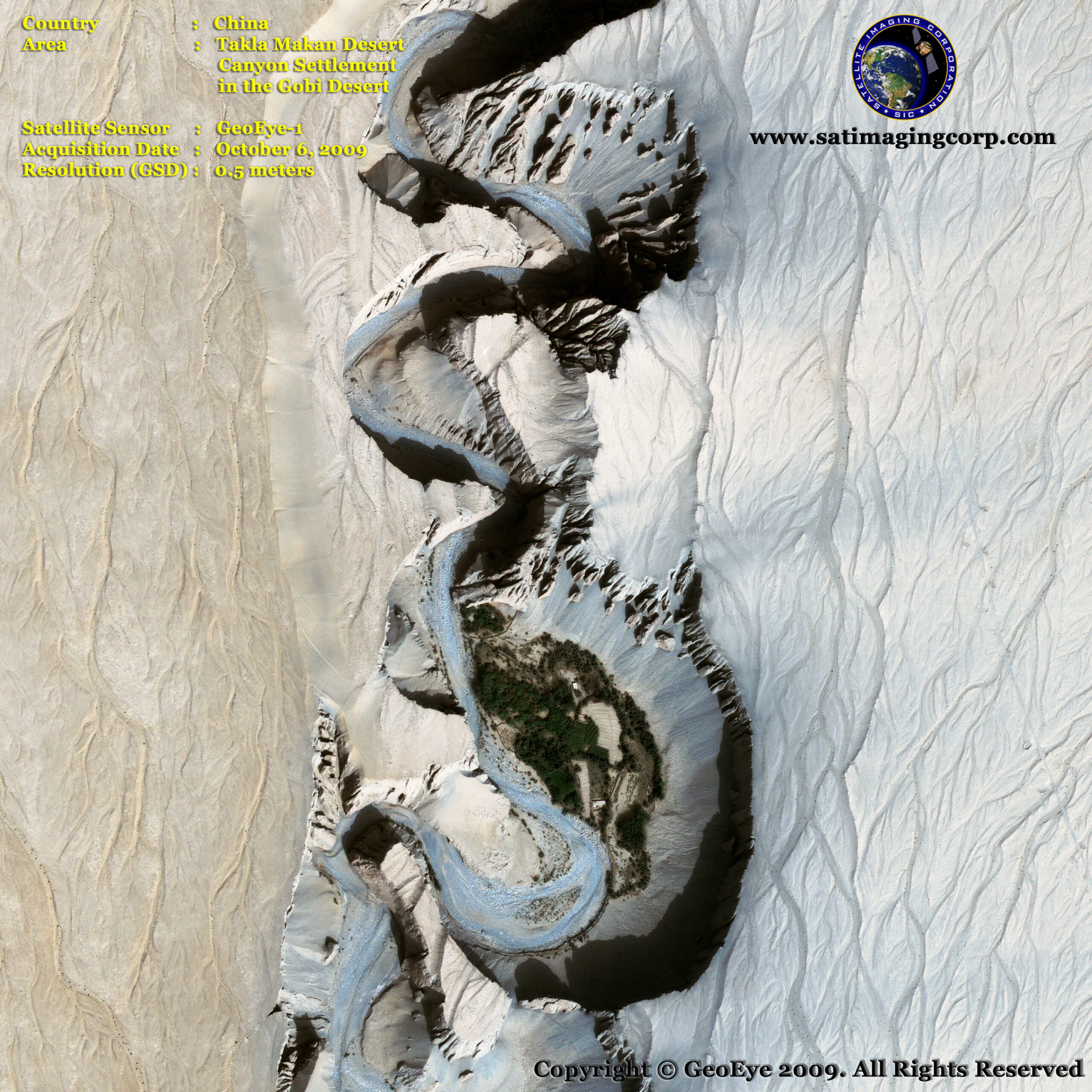
The Gobi desert is expanding at an alarming rate. The expansion is particularly rapid on the southern edge of China. Dust storms, which used to occur regularly in China, have seen a dramatic increase in occurrence in the past 20 years, mainly due to desertification, and causing further damage to China’s agriculture economy.
Desertification, land degradation, and drought deprive people of food and water and force millions to leave their homes. Desertification refers to the creation of new deserts through the degradation of drylands, which cover 40% of the world’s land surface. Land degradation, caused by over-cultivation, over-grazing, deforestation, and inefficient irrigation, affects roughly 20% of Earth’s drylands.
GeoEye-1 Satellite Image of Takla Makan Gobi Desert, China
Image copyright © MAXAR – All rights reserved.
Satellite imaging technology has been recognized as playing an important role in achieving this objective by using these methods for monitoring the areas most at risk to support land and water management decisions.
Earth observation (EO) satellite technologies allow land degradation processes to be monitored over time. Monitoring desertification, land degradation, and droughts require continuous evaluation, some of which can be retrieved with earth observation technologies and state-of-the-art geospatial applications.
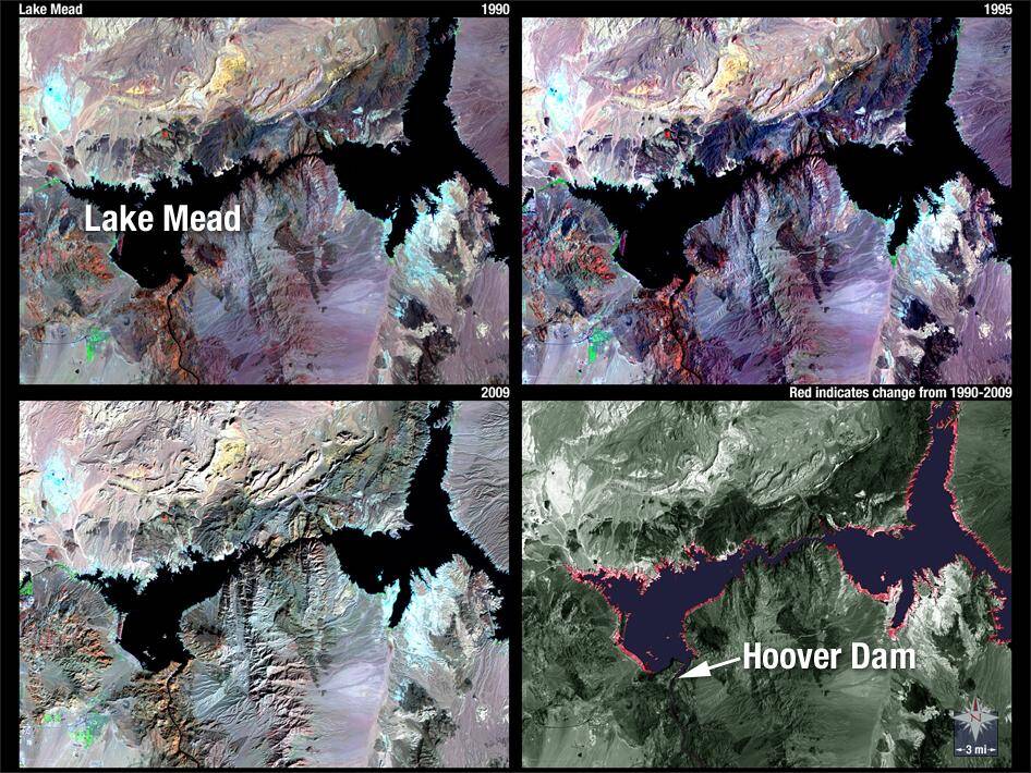
Landsat satellite image series from Lake Mead, we can see the diminishing water level of the reservoir between the 1990s and 2009. The red color in the lower right image shows where the water level has dropped. These false-color images use TM bands 7,4,2.
Credit: NASA/USGS


