Satellite Maps Haiti Earthquake
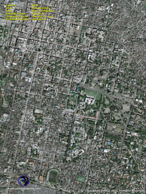
GeoEye-1 satellite sensor captured a high-resolution satellite image of the most devastating earthquake of the century that hit Port-au-Prince, Haiti on Tuesday, January 12th. The quake killed around 170,000 people possibly more and left one million homeless, without food or water as a result of a 7.0-magnitude earthquake.
The destruction of buildings, hospitals, and roads left Haitians with a shortage of medical supplies and doctors for the injured and no equipment to move the rubble and debris. With many dead and not knowing what to do, people are having to pile bodies in the streets and leaving many with no relief or hope.
GeoEye-1 Satellite Map Post Earthquake – January 13, 2010
Image copyright © MAXAR – All rights reserved.
GeoEye-1 satellite image above was taken from 423 miles in space at 10:27 am EST on Jan. 13, 2010, as it moved from north to south over the Caribbean at a speed of four miles per second. Ground resolution is half a meter (19 inches).
The 7.0-magnitude earthquake struck shortly before 5 p.m. Tuesday, centered about 10 miles (15 kilometers) southwest of Port-au-Prince, the U.S. Geological Survey reported. It could be felt strongly in eastern Cuba, more than 200 miles away due to the earthquake being shallow meaning that the energy that was released is very close to the surface. The earthquake’s power matched that of several nuclear bombs and about 3 million people were affected by the quake.
Haiti sits on a large fault that has caused catastrophic quakes in the past, but this one was described as among the most powerful to hit the region.
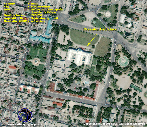
IKONOS (0.8 m) Satellite Image – President’s Palace (2008) Before the earthquake
Image copyright © MAXAR – All rights reserved.
GeoEye-1 Satellite Image – President’s Palace (2010) Post the earthquake
Image copyright © MAXAR – All rights reserved.
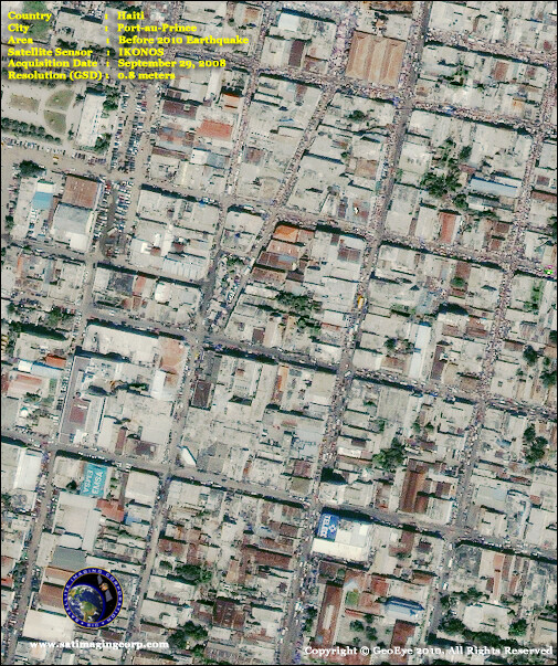
IKONOS (0.8 m) Satellite Image – (2008) Before the earthquake
Image copyright © MAXAR – All rights reserved.
GeoEye-1 Satellite Image – (2010) Post the earthquake
Image copyright © MAXAR – All rights reserved.


