Satellite Maps Toxic Red Sludge Hungary
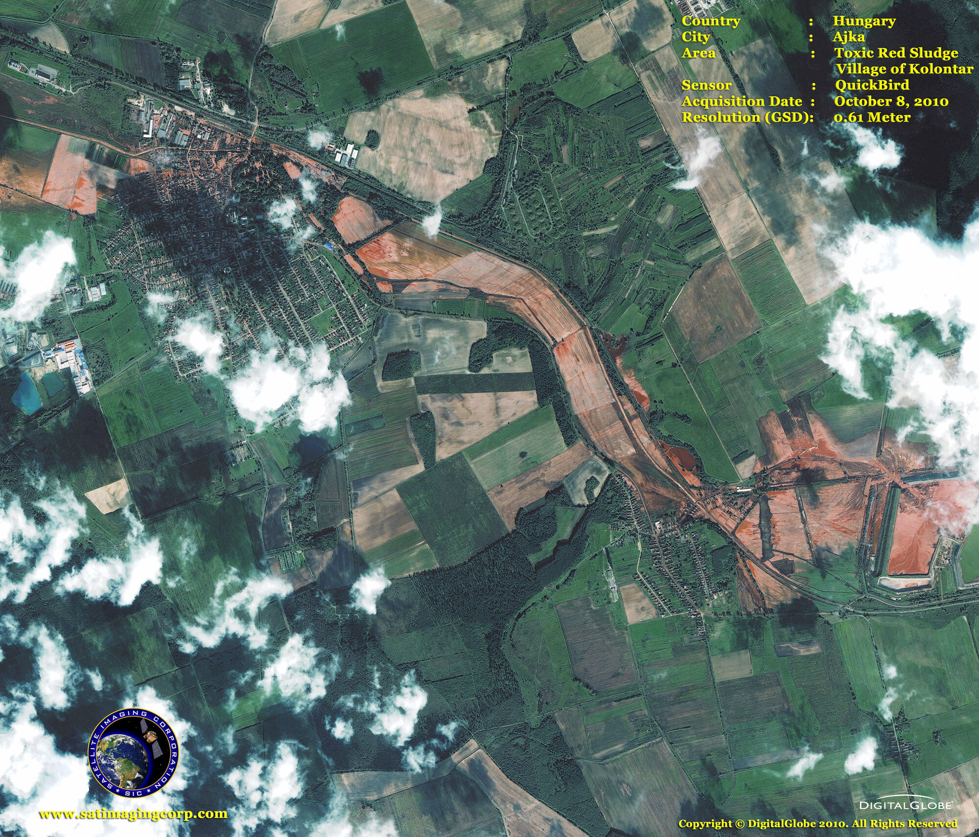
Satellite maps captured the environmental disaster of a contaminated waste reservoir that gave way to 24.7 million cubic feet of toxic red sludge on October 4, 2010, killing nine people, injuring 150, forcing home evacuations, and ruining property over 15 square miles.
The red sludge devastated creeks and rivers near the spill site and entered the Danube on Thursday, October 7, 2010, moving downstream toward Croatia, Serbia, and Romania.
IKONOS Satellite Map Toxic Red Sludge Hungary
Image copyright © MAXAR – All rights reserved.
The IKONOS one-meter resolution satellite image features a portion of Hungary’s toxic sludge spill east of Ajka, Hungary in the village of Kolontar. The image was taken on October 7, 2010, and shows a close-up of the holding pond where the red mud pollution broke through the retainer wall. On the same day, the image was captured authorities reported the spill had reached the Danube River, threatening to contaminate the waterway’s ecosystem. The image was collected by the IKONOS satellite from 423 miles in space as it moved from north to south over Hungary at a speed of 4.2 miles per second.
QuickBird Satellite Map Toxic Red Sludge Hungary
Image copyright © MAXAR – All rights reserved.
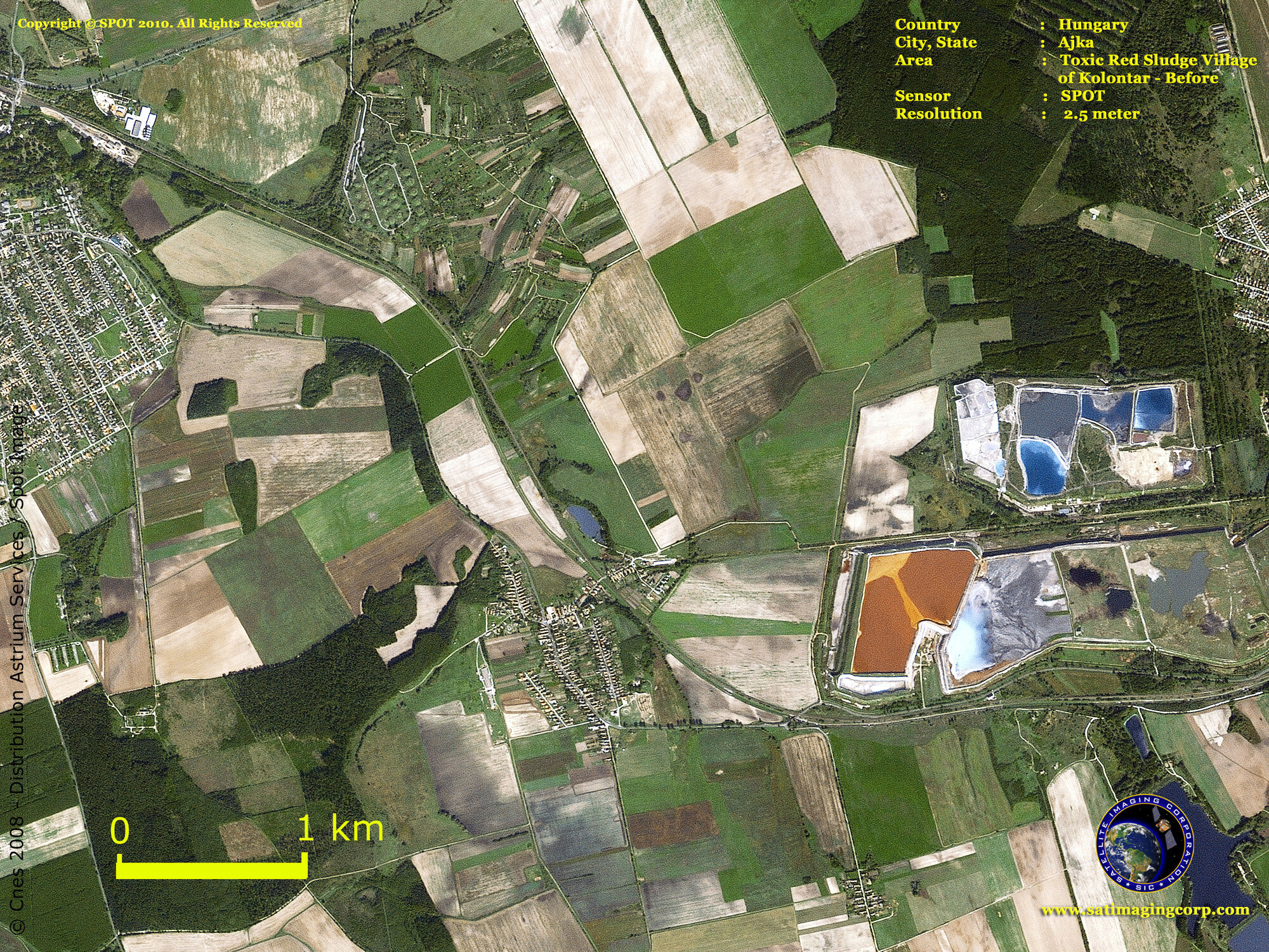
SPOT 5 Satellite Map of Reservoir in Ajka, Hungary – Before
Image copyright © AIRBUS Space and Defence – All rights reserved.


