Satellite Maps Fukushima Daiichi Tsunami Damage
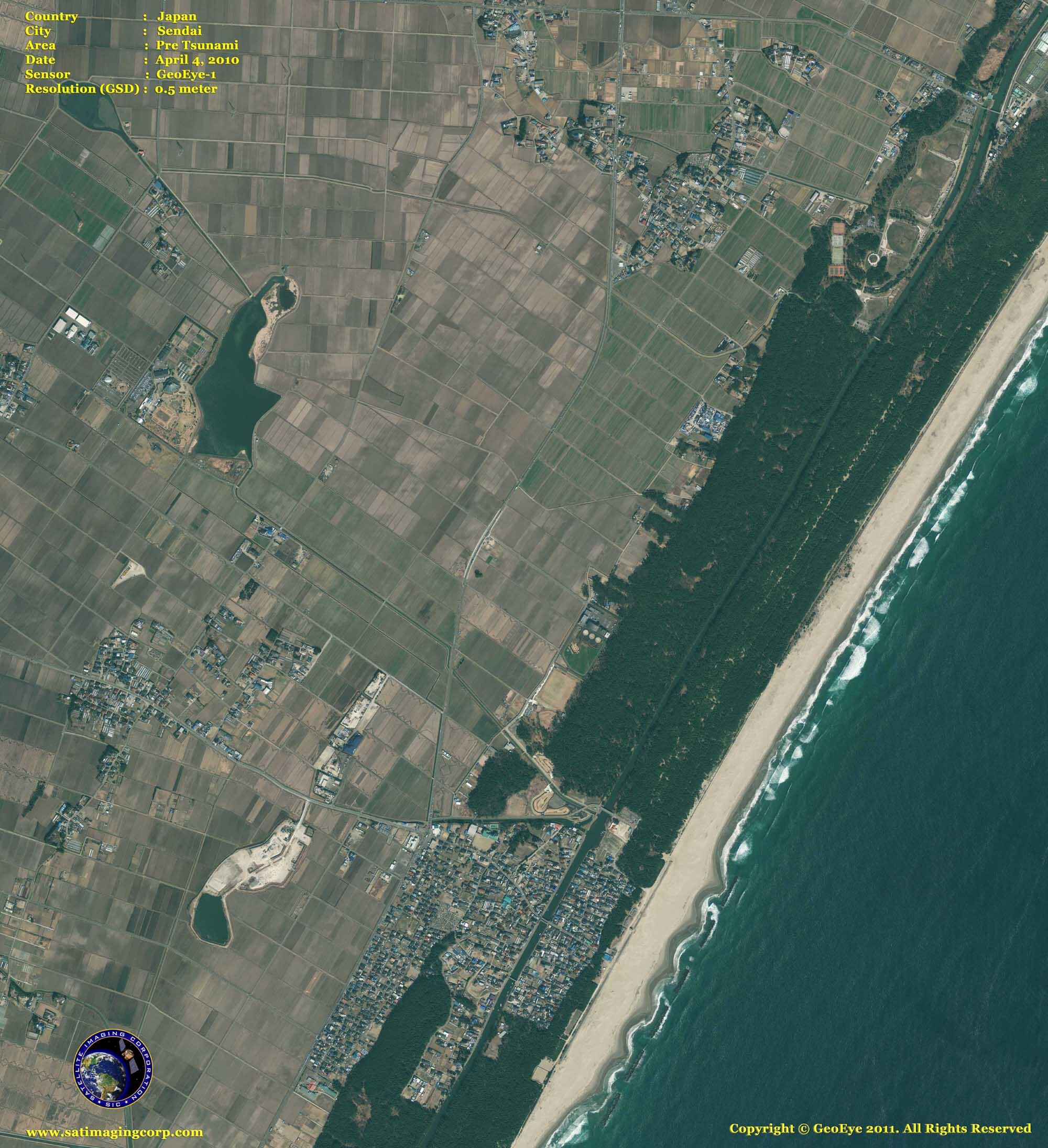
Satellite maps captured the catastrophic earthquake that caused a massive tsunami as a result of an 8.9-magnitude earthquake that hit northern Japan early Friday, March 11, 2011. The earthquake triggered a tsunami that caused damage to the Fukushima Daiichi Nuclear Plant. Thousands are unaccounted for while search and rescue efforts continue, fearing the death toll will rise in the thousands.
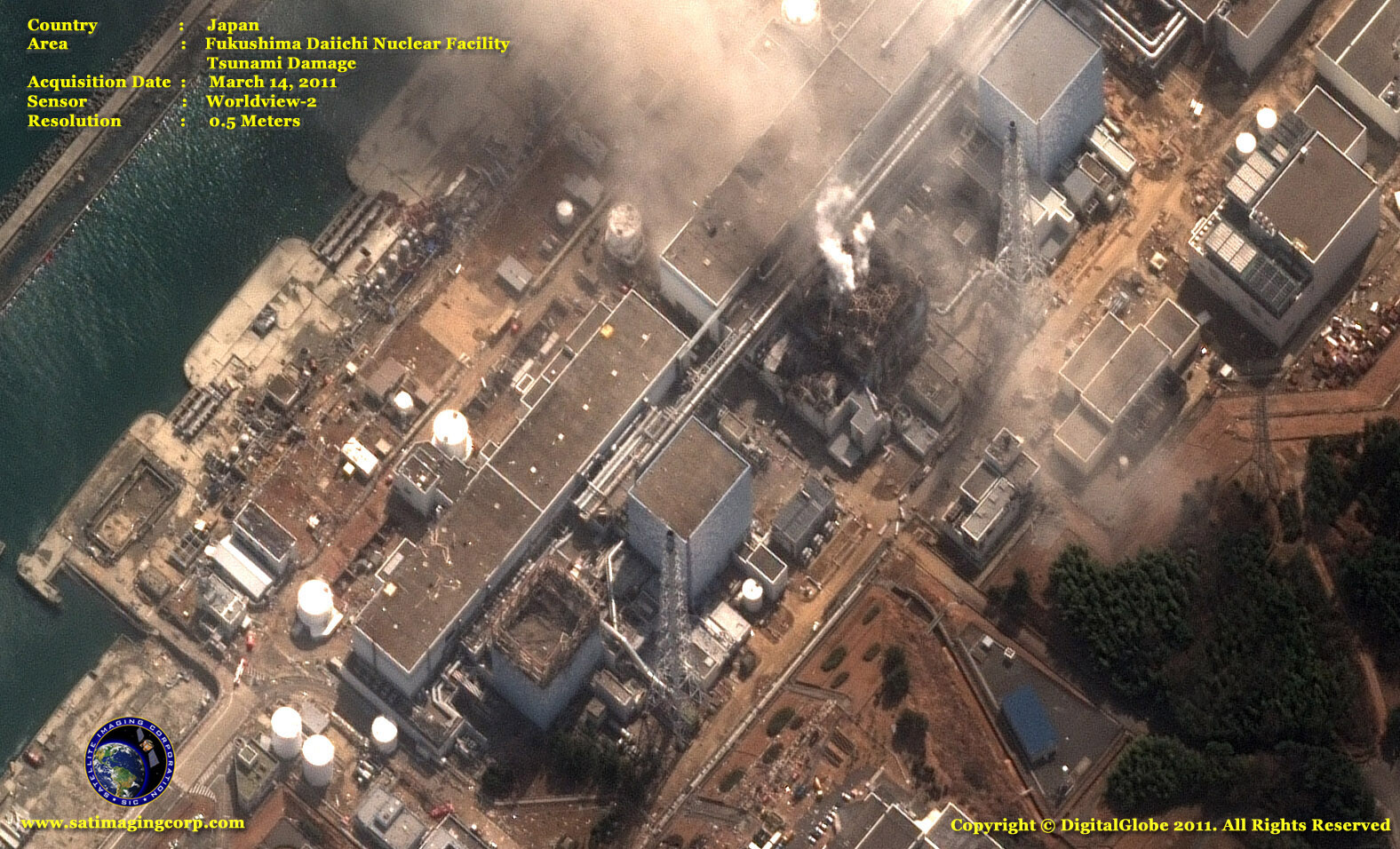
WorldView-2 Satellite Map Fukushima Daiichi Nuclear Power Plant – March 14, 2011
Image copyright © MAXAR – All rights reserved.
Japan’s troubled Fukushima Daiichi, appears in this WorldView-2 satellite image (above) that was captured following an explosion at Unit 3 on March 14, 2011.
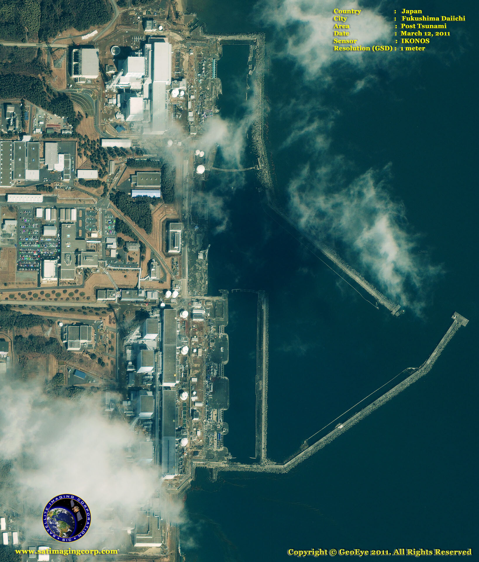
IKONOS Satellite Map Fukushima Daiichi Post Earthquake
Image copyright © MAXAR – All rights reserved.
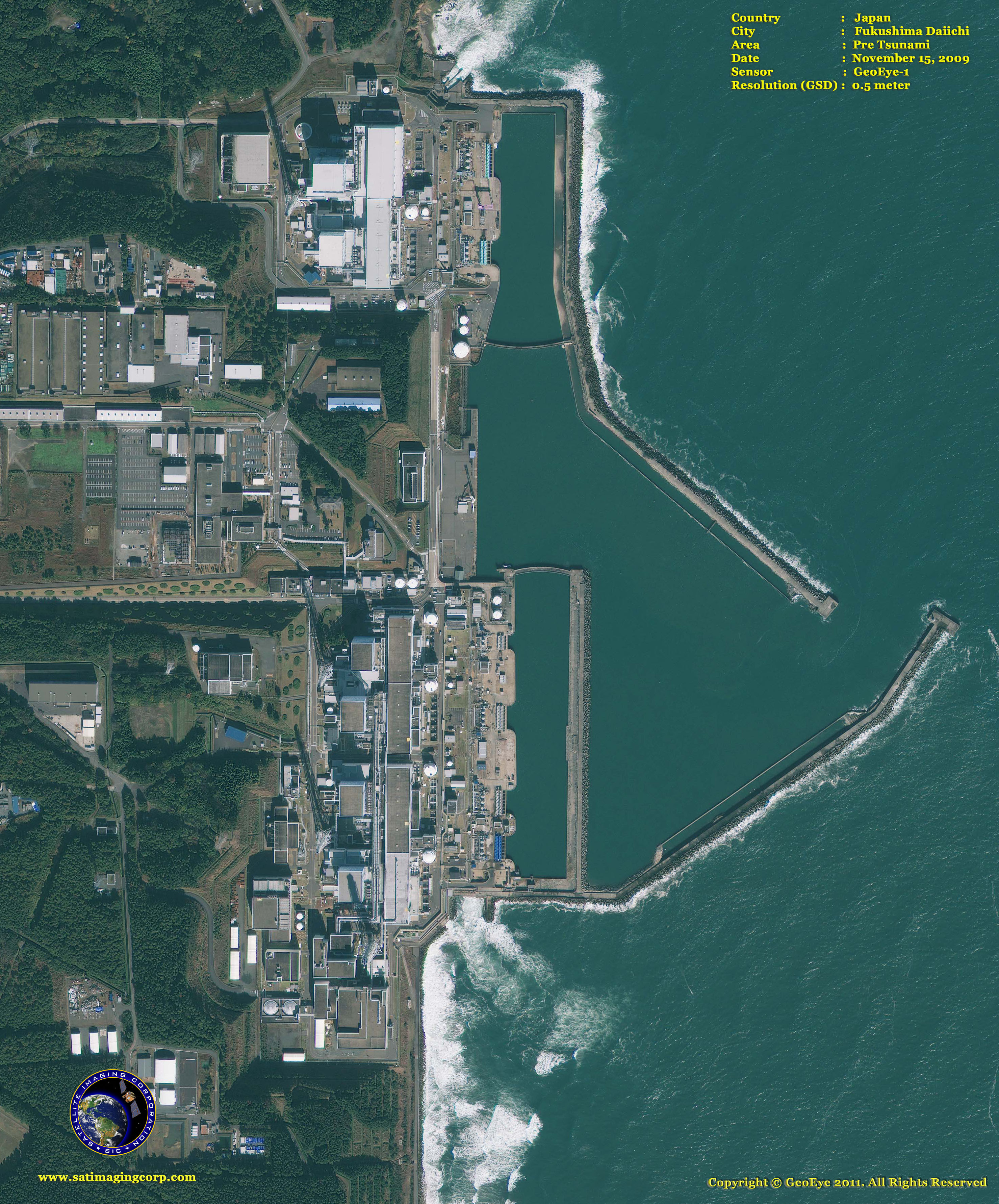
GeoEye-1 Satellite Map of Pre-Tsunami Acquired on November 15, 2009
Image copyright © MAXAR – All rights reserved.
Friday’s tsunami disasters damaged a series of nuclear reactors (satellite images above), first reactor No. 1, then No. 3, No. 2, and today No. 4 was reported on fire. Japan suspended operations to prevent a stricken nuclear plant from melting down Wednesday after a surge in radiation made it too dangerous for workers to remain at the facility.
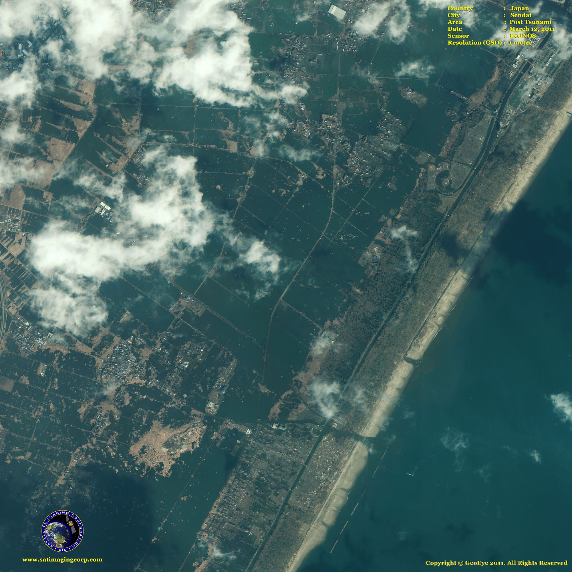
IKONOS Satellite Image of Post Tsunami Acquired on March 12, 2011 – Sendai
Image copyright © MAXAR – All rights reserved.
This one-meter resolution IKONOS satellite image of Sendai, Japan (above), was taken one day after an 8.9-magnitude earthquake struck the Oshika Peninsula on March 11, 2011. According to news reports, this is the largest earthquake to hit Japan in recorded history. Analysts believe the powerful earthquake moved Japan’s main island eight feet (2.4 meters), shifted the Earth on its axis four inches (10 centimeters), and unleashed a devastating tsunami. The imagery shows extensive destruction to buildings, vehicles, and infrastructure. Entire regions have been flooded, swept away, or reduced to ruin. The image was taken by GeoEye’s IKONOS satellite at 10:36 a.m. (local time) on March 12, 2011, from 423 miles in space as it moved from north to south over Japan at a speed of four miles per second.
GeoEye-1 Satellite Map of Pre-Tsunami Acquired on November 15, 2009
Image copyright © MAXAR – All rights reserved.


