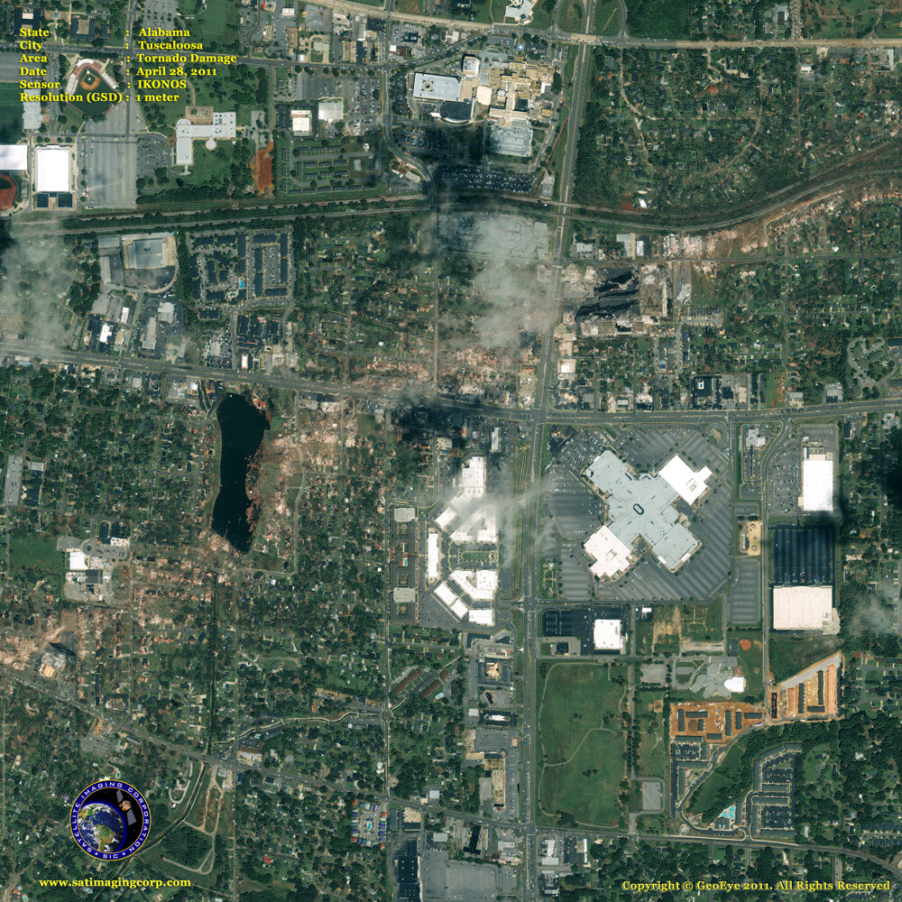
Satellite Image EF4 Tornado Damage Alabama
IKONOS satellite captured the destruction of an EF4 tornado that hit Tuscaloosa, Alabama, and other areas of the South on Wednesday, April 27th. The tornado had a maximum width of half a mile and a path length of 2.82 miles. The death toll keeps rising with over 340 claimed dead. The twister alone may register as the most powerful long-track tornado in US history.
A series of tornadoes hit the South this week traveling in excess of 220 miles across Alabama, Georgia, and Tennessee. Approximately 211 tornadoes were reported within a few hour spans on Wednesday, including a series of so-called long-track twisters that raked across six states.
National Weather Service confirmed that an EF-5 tornado with winds up to 205 mph struck the city of Smithville Wednesday afternoon. The first EF-5 tornado to hit Mississippi since March 1966. EF-5 tornadoes are the deadliest.
IKONOS Satellite Image of Tuscaloosa, Alabama Tornado Damage
Image copyright © MAXAR. All Rights Reserved


