
3D Urban Terrain Model
Satellite Imaging Corporation (SIC) provides orthorectified mono and stereo satellite imagery which can be processed for visualization of 3D Urban Terrain Model conditions in 2 and 3 Dimensions (2D/3D). Production of digital elevation models (DEM) from various stereo satellite sensors including the WorldView-4 and WorldView-3 satellite sensors at 30cm resolution can support project planners, emergency operation managers, and logistics managers to plan field operations in a computer environment, ensuring that the best terrain conditions for project objectives.
In addition to the orthorectification of a satellite map, the digital elevation models are utilized in support of engineering designs, construction activities, mining and pre-planning/ lay-out of corridor surveys, land development, well sites, and environmental and geological survey applications.
Pleiades-1A (0.5m) Stereo Satellite Imagery – 3D Urban Terrain Model
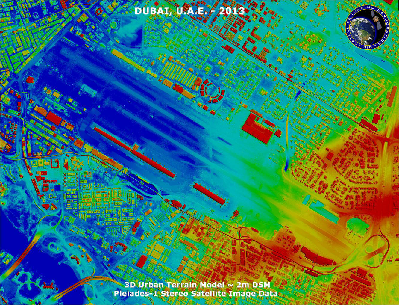
Copyright © AIRBUS Defence & Space/Processed by Satellite Imaging Corporation. All rights reserved.
3D Urban Terrain Model – West Bay – Doha, Qatar
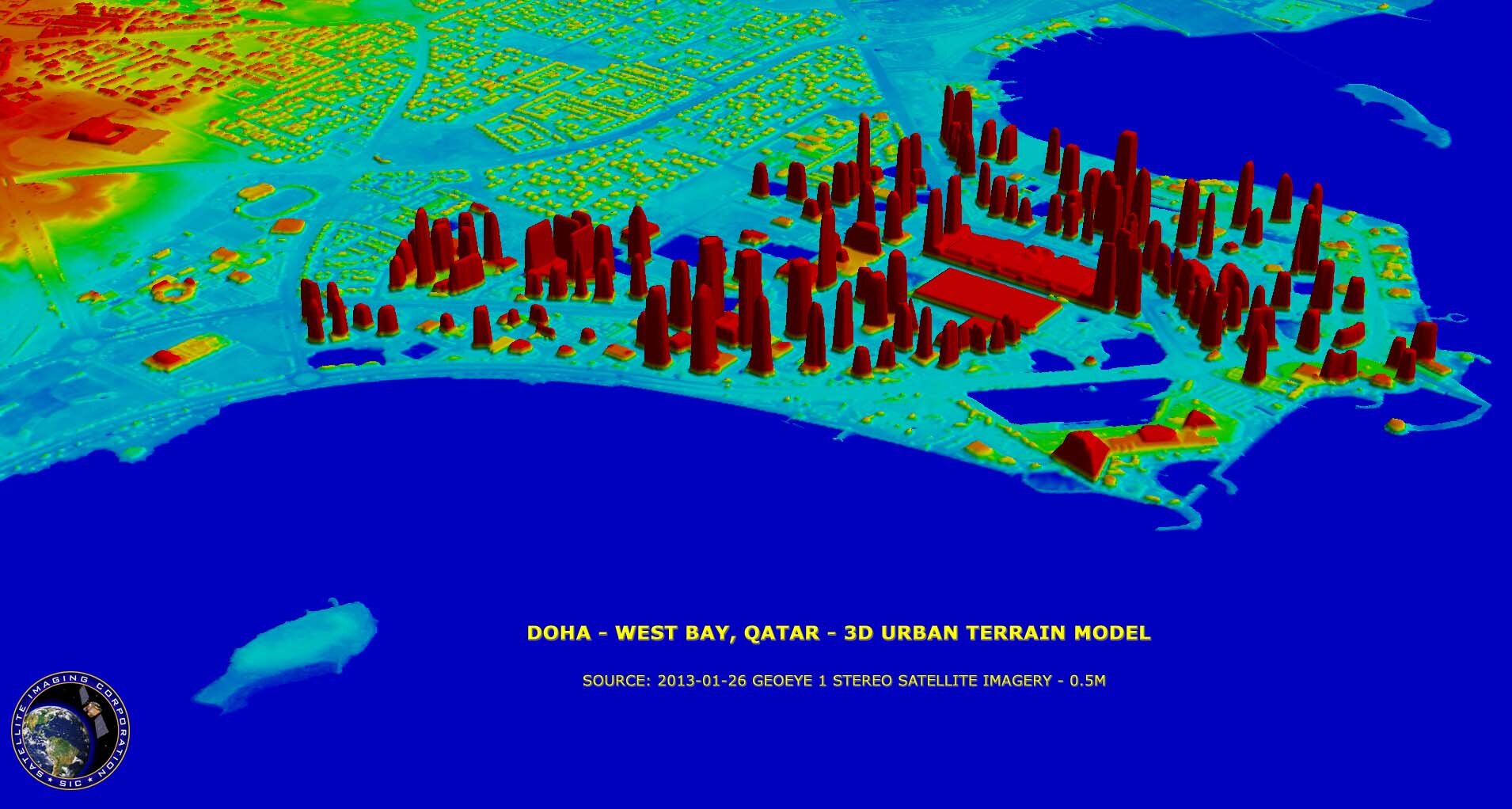
Image copyright © MAXAR/Processed by Satellite Imaging Corporation. All rights reserved.