
Satellite Maps Airport Mapping
High-resolution satellite maps for airport mapping can provide 3D Digital Surface Models (DSM) and Digital Terrain Models (DTM’s) to support airport and aviation operations to show details and data for the construction of airport runways, airport terminals, airport layout design, airspace analysis, obstruction surveys, facility mapping, taxiways, aprons/parking areas, 3D flight simulation for pilot training, aircraft operations, and GIS database development.
WorldView-2 (0.5m) Satellite Image
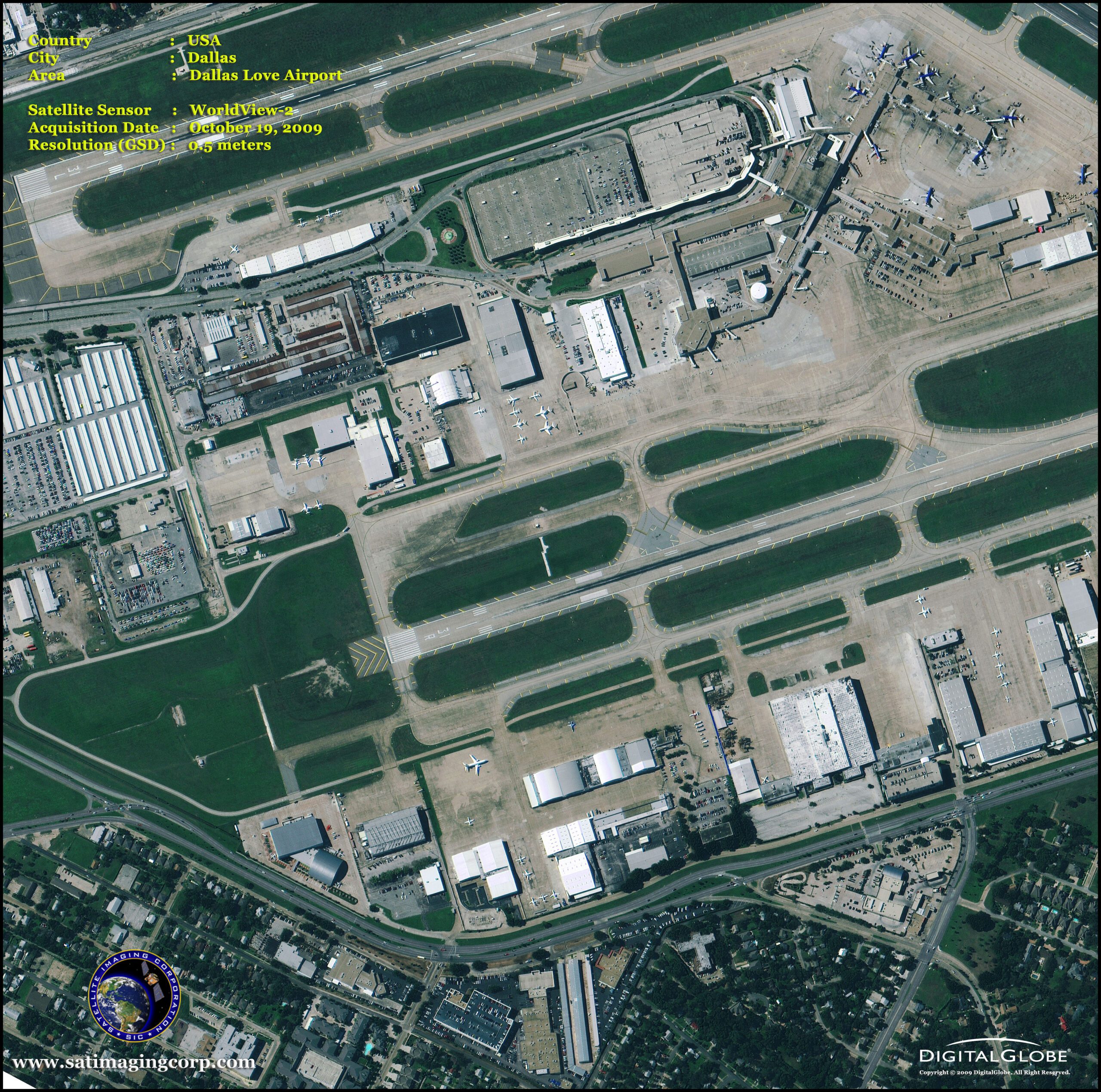
Image copyright © MAXAR. All Rights Reserved
Pleiades-1 3D Urban Terrain Model of Dubai, U.A.E.
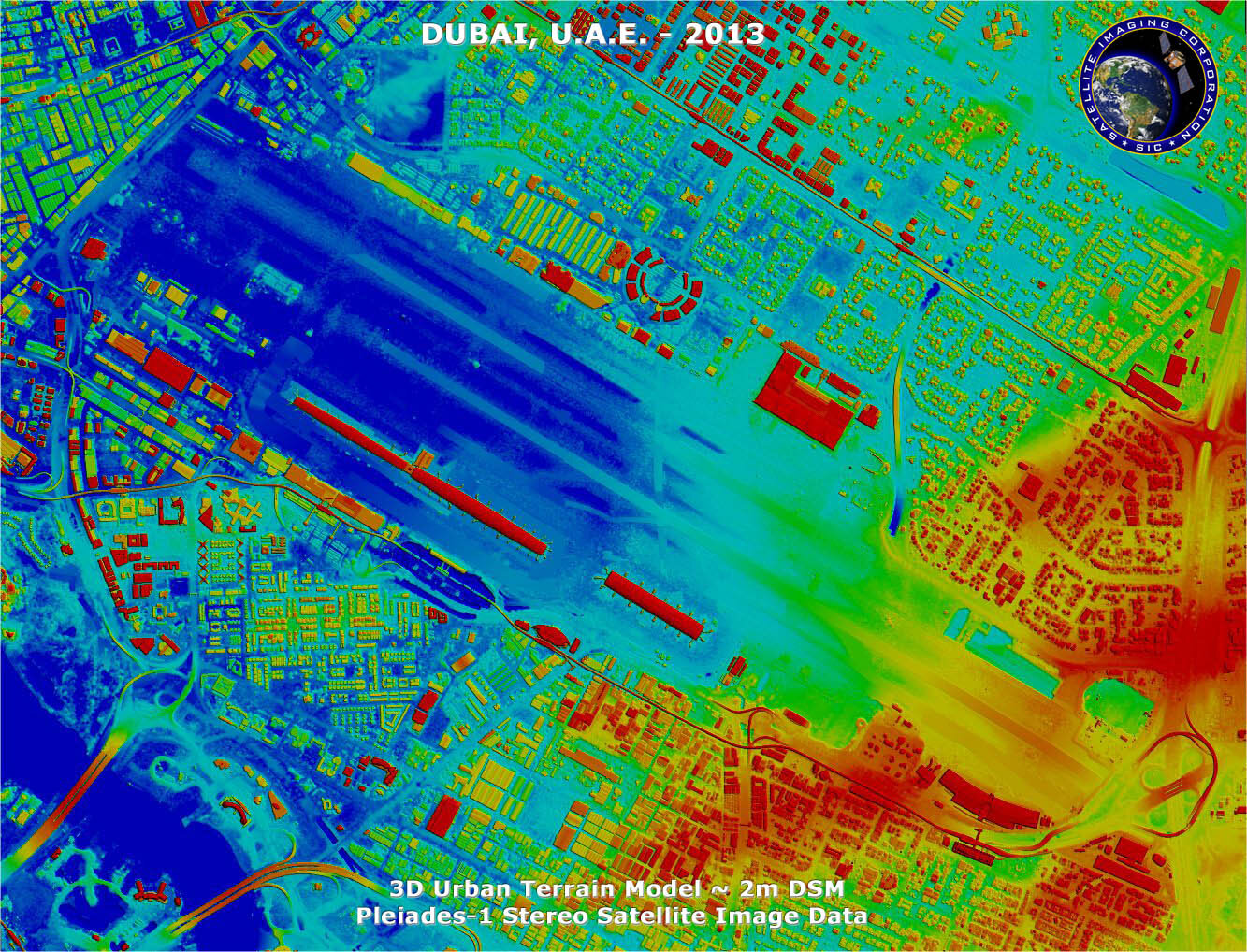
Image Copyright © AIRBUS Defence & Space/Processed by Satellite Imaging Corporation. All rights reserved