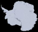
Satellite Image Mosaic Antarctica
More than a thousand scenes captured during seven years of satellite images have created the visually stunning true-color Landsat Image Mosaic of Antarctica (LIMA) by NASA, USGS, National Science Foundation (NSF), and British Antarctic Survey (BAS). The virtually cloudless satellite view of Antarctica’s frozen landscape provides much greater detail for the entire continent than ever before.
To View Images in Full Resolution Click on Images
Landsat Image Mosaic of Antarctica
The mosaic is made up of about 1,100 satellite images from Landsat 7, nearly all of which were captured between 1999 and 2001.
Landsat Image – Pourquoi Pas Island, Antarctica Peninsula
Advances in satellite technology since the 1970s have revolutionized the scientific study of the Earth’s greatest natural laboratory. For example, the movement of glaciers, previously measured by ground-based measurements or aerial photography, is now much better understood as a result of upgraded instruments on each new Earth-observing satellite. This will help society and world leaders make informed decisions and come up with strategies to cope with global change. The mosaic is made up of about 1,100 images from Landsat 7, nearly all of which were captured between 1999 and 2001. The collage of images contains virtually no gaps in the landscape, other than a doughnut hole-shaped area at the South Pole because the orbital limits of Landsat mean that anywhere south of 83degrees cannot be imaged. LIMA shows virtually no seams between images. Each pixel’s color represents the true reflectance of light off the surface, a quality useful to scientists.
Resources:
British Antarctic Survey


