
3D Urban City Modeling
3D Urban and City Modeling have a variety of applications in geography and urban studies. Accurate cartographic feature extraction, map updating, digital city models, and 3D city models in urban areas are essential for many applications, such as military operations, disaster management, mapping of buildings and their heights, simulation of new buildings, updating and keeping cadastral databases current, change detection and virtual reality. While they are generally used to simply visualize the built environment, there are early signs of them being used as 3D interfaces to more sophisticated simulation models.
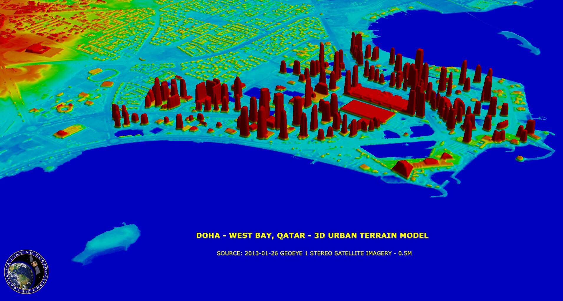
Image copyright © MAXAR/Processed by Satellite Imaging Corporation – All rights reserved.
Just a few years ago, the main input data for the production of digital city models and 3D city models were aerial images, terrestrial images, map data, and data derived from classical surveying. The process of geospatial information extraction from these sources was performed manually, but today with the availability of high-resolution satellite sensors, satellite images can support the generation of a three-dimensional dense, geo-referenced terrain surface.
3D models can be used as a user-friendly interface for querying the urban environment as a Geographic Information System (GIS), for hyper-linking Web-based information, for visualizing model results, and for accessing functional simulation models.
3D terrain modeling and visualization application require good detail pertaining to the terrain features and terrain slopes for critical project decisions, an accurate digital terrain model (DTM) and a digital surface model (DSM) must be available.