
Atmospheric Compensation
Atmospheric Compensation (AComp) is an algorithm that removes haze and vapor particles and is used to correct and clarify high-resolution panchromatic and multispectral satellite images (including SWIR bands) under diverse atmospheric conditions. AComp cuts through haze providing accurate analysis to support feature extraction applications from high-resolution satellite imagery including WorldView-2, WorldView-3, WorldView-4, GeoEye-1, WorldView-1, QuickBird, and IKONOS satellites, and image data from other satellite sensors.
Left: Top-of-Atmosphere Reflectance – Richt: Surface Reflectance
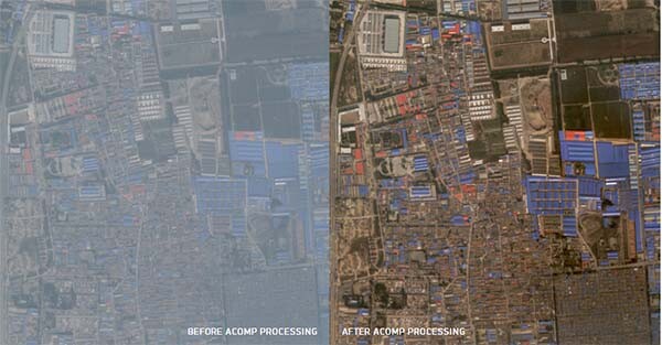
Image copyright © MAXAR. All Rights Reserved
AComp can greatly benefit industries including oil and gas, agriculture, defense and intelligence, mining, and disaster relief efforts.
What AComp does:
- Minimizes haze effects while preserving the full spectral information in reflectance pixel values
- A fully automated process, available on the entire satellite constellation
- Significantly improves the accuracy of image mining and machine learning algorithms
- Provides normalized surface reflectance values across every pixel
- Facilitates cross-sensor processing, by enabling comparison across other satellites
- Removes significant errors in the comparison of images over time
- Compatible across both panchromatic and multi-spectral images