AI and Satellite Maps Agriculture Mapping
The latest innovation in capturing precise and accurate data has been the utilization of Artificial Intelligence (AI), Machine Learning (ML), and Computer Vision (CV). AI and ML models have great success in many fields related to obtaining large amounts of image data to aid in pattern recognition and create algorithms through computer systems. AI and ML can help the end data used to understand the data collected in order to find resolutions to the focused project at hand, rapidly. AI can improve in the analysis of large areas of interest, classify objects, detect and monitor land use, data fusion, cloud removal, and spectral analysis of environmental changes from satellite or aerial imagery.
AI and satellite imaging technology can create Computer Vision models to better understand the data. Images collected by satellites or unmanned aerial vehicles (UAV), can provide near real-time reports for large-scale sized areas with complex feature distribution such as in the applications of agriculture, urban planning, transportation, disaster management, climate change, and wildlife conservation. AI can aid in data collection, processing, and understanding using neural networks and deep learning through Computer Vision models to allow data users to better understand and handle data more efficiently in a timely manner.
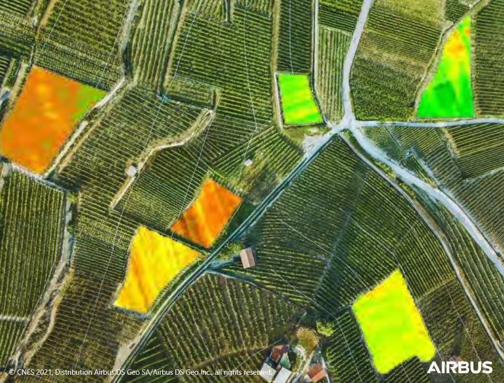
Agriculture Mapping – Pleiades Neo 3 Satellite Sensor (30cm)
Image Copyright © AIRBUS Defence & Space. All Rights Reserved.
AI for Agriculture Applications
Statistics show that the world’s population will reach 9.1 billion by 2050. Due to this expected growth, there is pressure worldwide for higher agricultural production and reliable crop status information. To achieve these objectives, improved management of the world’s agricultural resources is required, especially in developing countries.
Utilizing high-resolution, multi-spectral satellite images and AI, ML, and CV algorithms, image data is collected and processed, extracting spectral analyzed data and transferred into management solutions for crop health and improved production targets.
AI and Geographic Information Systems (GIS) tools can help farmers to conduct crop forecasting and manage their agriculture production by utilizing image data collected by satellites, fix wing aircraft, or unmanned aerial vehicles (UAV). This data is collected and processed to provide NDVI and many other vegetation indices to identify crop stress, and production yields, and manage tree grading. The ability of AI and GIS to analyze and visualize agricultural environments and workflows has proven to be very beneficial to those involved in the farming and agricultural industries.


