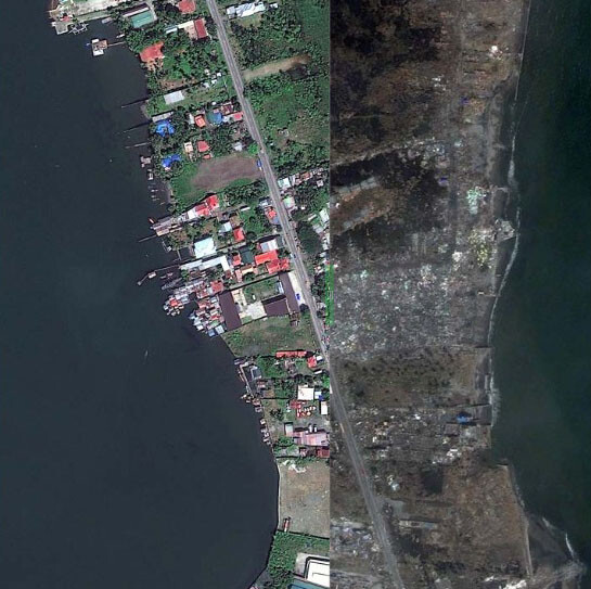
Satellite Maps Typhoon Haiyan
Typhoon Haiyan (also known as Typhoon Yolanda) caused widespread devastation when it struck the Philippines on November 7, 2013. With maximum sustained winds of 195 mph (314 km/h) and a storm surge of 20 feet, the typhoon is among the strongest ever to make landfall.
Military, government, and international relief agencies are trying to get emergency aid to the worst-hit areas but rescue efforts have been difficult due to damage to roads and airports. An estimate of up to 5,000 or more people have died in Tacloban city and elsewhere with hundreds of thousands of people displaced seeking food and water and running out of time.
WorldView-2 Satellite Image Typhoon Haiyan
Click on the image to view before and after images
Image copyright © MAXAR. All Rights Reserved


