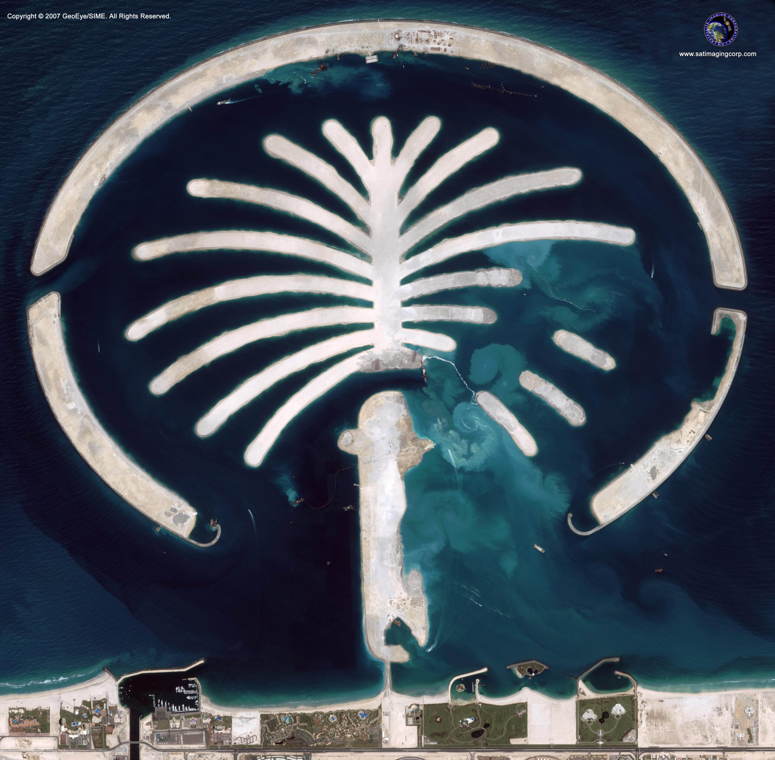
Satellite Image Animation of Palm Jumeirah Island
Satellite image animation of Palm Jumeirah island development and construction project supported engineering companies to organize, plan, and monitor Dubai’s number one tourist destination. The three large man-made resort islands (Palm Jumeirah, Jebel Ali, and Deira) are built on the shorelines of Dubai, UAE which added 520 km of beaches to the city. Two of the islands are designed in the shape of a date palm tree and the most current project, island Deira will be shaped in a corniche.
The palm islands are artificial peninsulas constructed of sand dredged from the bottom of the Arabian Gulf which is sprayed by dredging onto the required area in a process known as rainbowing due to the way the sand arcs when sprayed. The outer edge of each Palm encircling crescent is a large rock to the breakwater. The island supports luxury hotels, freehold residential villas, unique water homes, shoreline apartments, marinas, water theme parks, restaurants, shopping malls, sports facilities, health spas, cinemas, and various diving sites.
Satellite Image Animation of Palm Jumeirah Island, UAE
Construction and Development
Development
The project took four years of planning to ensure that the project would not disrupt the environment during its development. The development of each island included the construction of the land foundations with sand transfer and rock placement, followed by building the infrastructure, supplying utility services, bridges linking the islands to the mainland, and construction of homes and resorts.
The third island Palm Deira at 1.14 billion cubic meters of sand and will be the world’s largest man-made island and will reside homes to about one million people and should be expected to be completed by 2015.


