
3D Terrain Model North Korea Nuclear Facilities
Satellite Imaging Corporation created a 3D Terrain Model Flythrough movie of North Korea’s Yongbyon nuclear facilities to provide high-resolution details of the 5 and 50 MW (e) reactors and other nuclear facilities.
History of Yongbyon:
A “freeze” was ordered by inspectors from the IAEA in July of 2007 on North Korea’s main source of plutonium, the 5 megawatt-electric reactor — MW (e) at the Yongbyon nuclear site and its nearby plutonium separation plant, the Radiochemical Laboratory (see associated Images). This freeze was ordered under the “Agreed Framework” with the United States. The nuclear site will be monitored through satellite images, surveillance cameras, and short-notice inspections to assure that there will be no activities within the site.
<1m Stereo IKONOS Satellite Image Data and 2m DSM
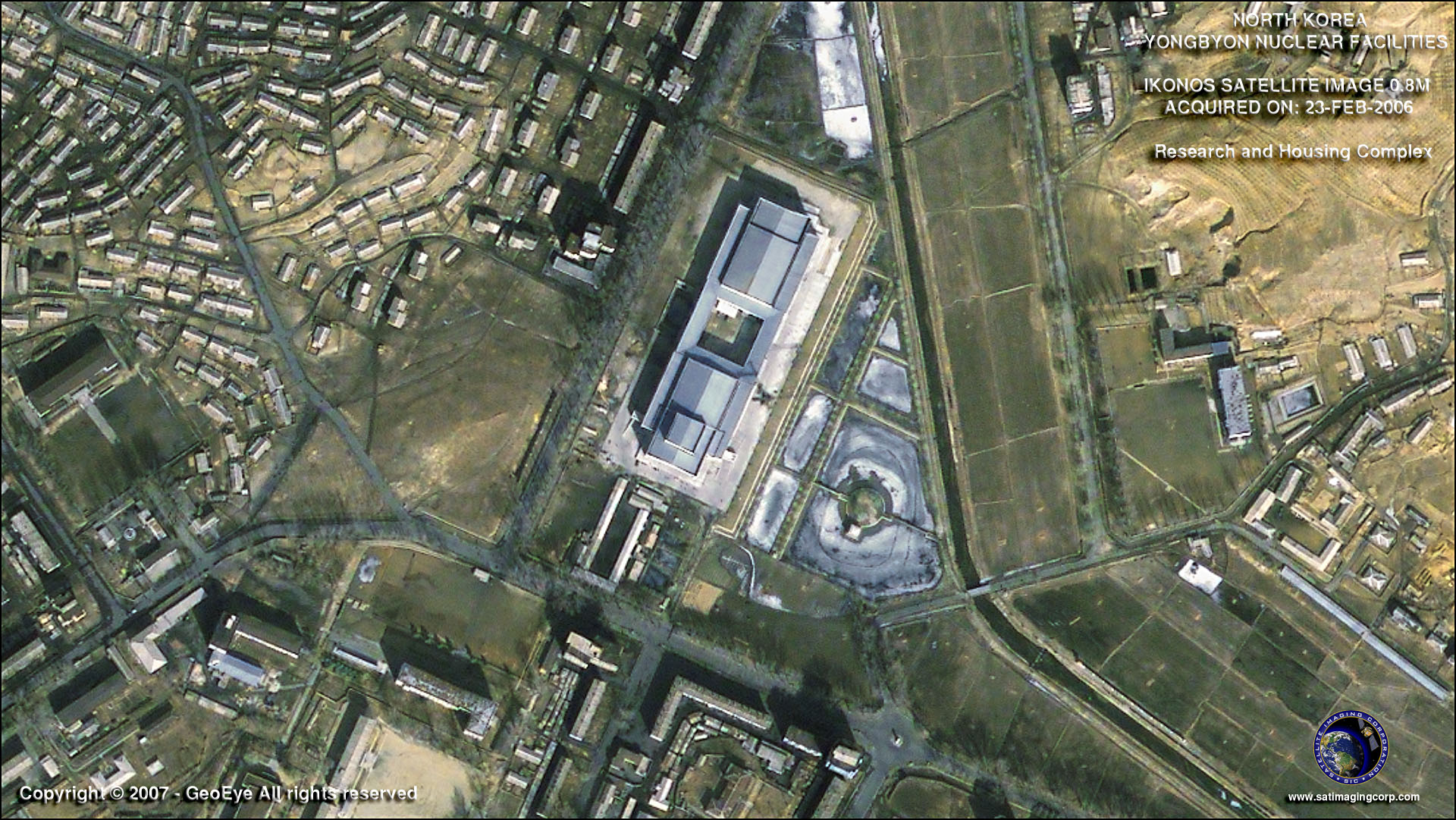
IKONOS Satellite Image (0.8m) – Research Facility
Broadband connection and QuickTime player required – Size: 21 MB
Copyright © MAXAR/Processed by Satellite Imaging Corporation. All rights reserved.
IKONOS Satellite Image (0.8m) – Radio Chemical Laboratory
Copyright © MAXAR. All rights reserved.
Construction of the gas-graphite reactor began in 1980. It is believed to have been made operational in 1986-1987. The 5-megawatt-electric reactor is estimated to produce about 5-7 kilograms of plutonium each year for North Korea a total estimated plutonium stock of between 46kg and 64kg, of which about 28-50 kg is estimated to be in separated form and usable in nuclear weapons. In 1989, high-altitude aerial photographs showed the presence in Yongbyon of a structure that could possibly be used to separate plutonium from nuclear fuel. Between 1994 and 2003, North Korea’s stock of separated plutonium was enough to create 4 to 13 nuclear weapons.
IKONOS Satellite Image (0.8m) – 5 MWe Reactor

IKONOS Satellite Image (0.8m) – 50 MWe Reactor

Copyright © MAXAR. All rights reserved.
Before Yongbyon was shut down, international observers tried to determine when the reactor was in use by analyzing satellite images that showed steam plumes coming from the cooling tower.
Although the closure of Yongbyon is seen as a major breakthrough concern remains over Pyongyang’s commitment to fully give up its nuclear arsenal.
Unclassified reports were confirmed by satellite images which indicated that North Korea shut down the reactor in April 2005, likely to unload the fuel. The reactor’s core was estimated to have contained 10-15 kilograms of plutonium.
IAEA inspectors regularly monitor the 5-MW (e) reactor, the fuel fabrication plant, and the reprocessing plant. IAEA uses all technical means available to monitor the freeze at these facilities. Newly acquired Mono and Stereo Satellite images continue to support the monitoring of the site for any significant construction activities. Due to the long inactivity period and weather issues, the completion of this reactor would likely take several years. If finished, the 50-megawatt-electric reactor could produce enough plutonium annually for roughly ten nuclear weapons.