Satellite Maps Iran’s Hidden Nuclear Site
The GeoEye-1 satellite sensor captured Iran’s hidden nuclear site under construction near Qom in September 2009. Hidden in the hills, construction was started at the uranium enrichment site in 2006. The complex is on a military base controlled by Iran, making access difficult. But through information from satellite imagery, Iranian dissidents, and other human intelligence, a sufficiently detailed picture was built up to convince investigators that Iran was preparing to make nuclear fuel there.
According to IHS Janes, who did the analysis of the imagery, the satellite imagery shows a well-fortified facility with the main entrance, which was seen under construction early this year and is now a building that abuts and provides access to the mountain. Small round ventilation shafts in the center of the mountain are near completion. Quarry equipment, a surface-to-air missile site, and more construction equipment surround the mountain. This facility is still under construction.
The small-scale site discovered near Qom is meant to house no more than 3,000 centrifuges. The enriching machines in Qom facility will produce nuclear fuel, which could possibly be further enriched into material for atomic warheads.
The global standoff over Iran’s nuclear program began in 2002 with the discovery of two large nuclear facilities in Natanz and Arak. Tehran insists its nuclear program is for peaceful purposes to generate electricity. Iran says it has built the facility inside a mountain next to a military site to protect its nuclear activities in case of an attack by the US or Israel.
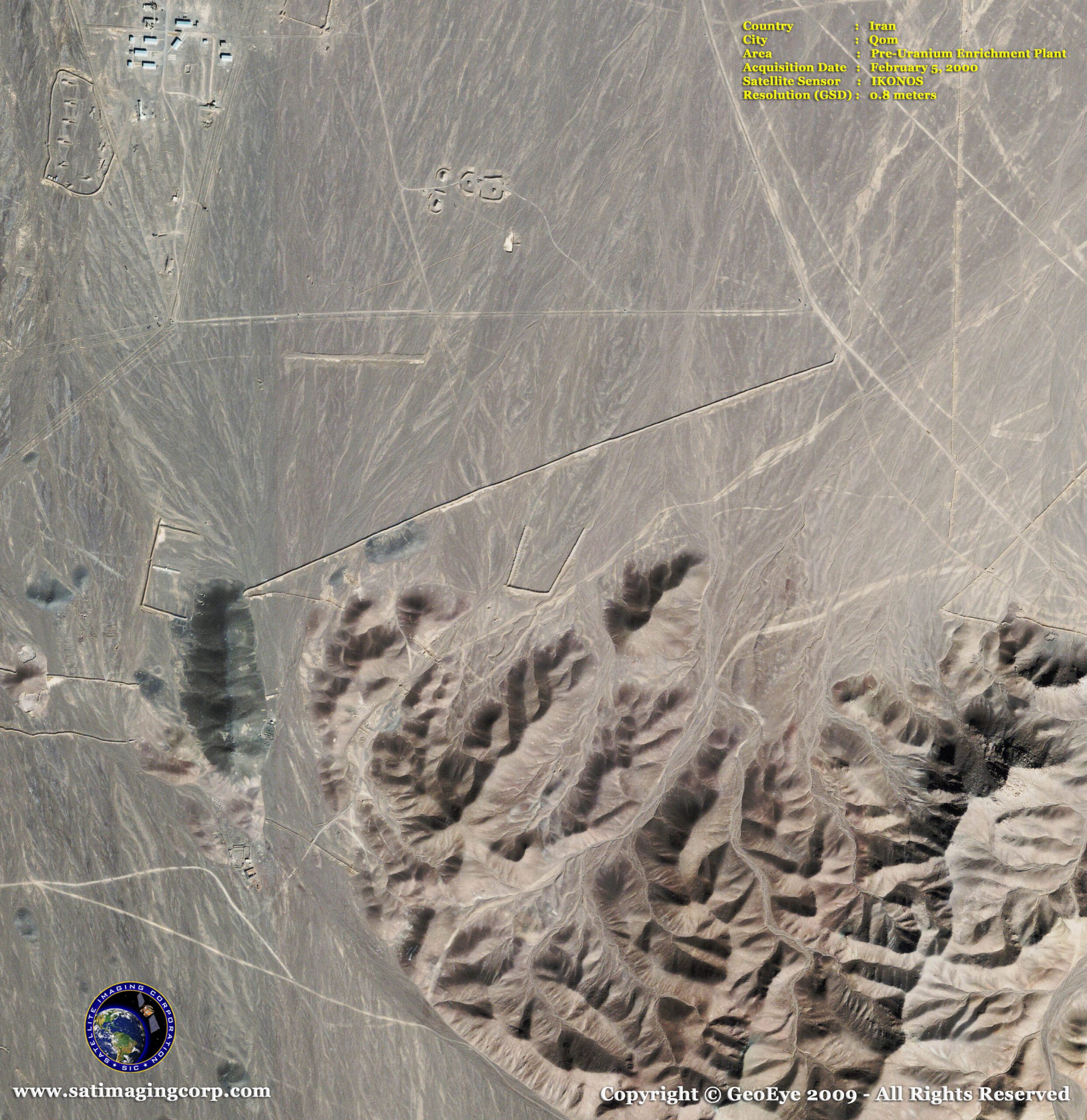
GeoEye-1 Satellite Images of Uranium Enrichment Nuclear Site – Qom, Iran
Image copyright © MAXAR – All rights reserved.
The IKONOS satellite sensor collected this 0.8m satellite image on February 5, 2000, showing pre-construction, and imagery from the GeoEye-1 satellite (below) shows present construction. GeoEye-1 image taken on September 26, 2009, from 423 miles in space as Virginia-based GeoEye’s newest satellite, GeoEye-1, moved from north to south over the Middle East at a speed of 7.5 km per second.
Image copyright © MAXAR – All rights reserved.
Image copyright © MAXAR – All rights reserved.


