
Satellite Map Mount Nyamulagira Volcano
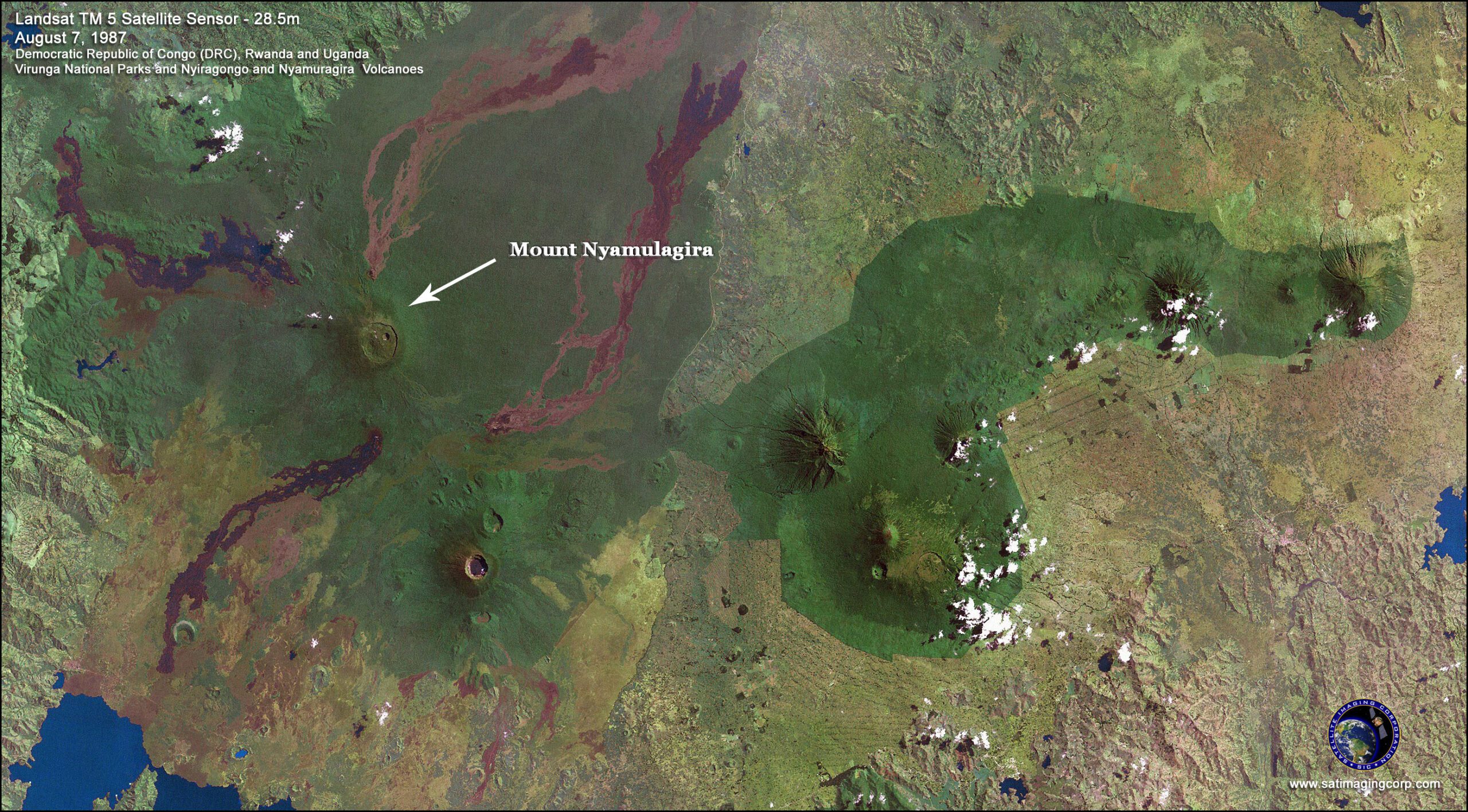
Satellite image of Virunga National Parks Mount Nyamulagira (also known as Nyamuragira) is one of Africa’s most active volcanoes, if not the most active that last erupted in 2006. About 25 kilometers north of Lake Kivu, and located to the northwest of Nyiragongo Volcano, it contrasts with its tall, steep-sided neighbor. Nyamulagira is relatively short. It is a shield volcano with gentle slopes. Shield volcanoes derive their name from their resemblance to metal shields warriors once used. Major eruptions at Nyamulagira have occurred recently enough to change the volcano caldera’s structure since the early 20th century.
Landsat TM 5 Satellite Image Virunga National Park DRC
Conservation requires work at many levels, from locally to internationally, and involves protection and law enforcement as well as research and education. Active conservation involves frequent patrols in wildlife areas to guard the park against poachers, enforce laws, census counts in regions of breeding, and protection of habitats.
Virunga National Park contains the greatest diversity of habitats of any park in Africa, from steppes, savannas, lava plains, swamps, lowlands, and forests to volcanoes. Hippopotamuses and elephants live in the park’s rivers and its mountains are a critical area for the survival of the mountain and lowland gorillas.
3D Flythrough Movie – Visoke Volcano

https://www.youtube.com/watch?v=2pwESvBB7Ww
1m Stereo IKONOS Satellite Image Data and 5m DTM