
Satellite Map Eyjafjallajokull Volcano
IKONOS satellite captured a satellite image of Iceland’s Eyjafjallajokull volcano erupting on Wednesday, sending ash drifting over Europe. Three of the biggest airports – Heathrow, Paris-Charles de Gaulle, and Frankfurt were closed due to excessive ash cloud coverage. The ash cloud is now spreading toward Greece.
This one-meter resolution satellite image features the Eyjafjallajokull Volcano, located in southern Iceland near the Eyjafjallajokull Glacier. According to news reports, the volcano erupted on March 20, 2010, for the first time in almost 200 years. The image was taken by the IKONOS satellite from 423 miles in space on March 31, 2010, as it moved from north to south over Iceland at a speed of four miles per second.
IKONOS Satellite Map of Eyjafjallajokull Volcano Eruption in Iceland
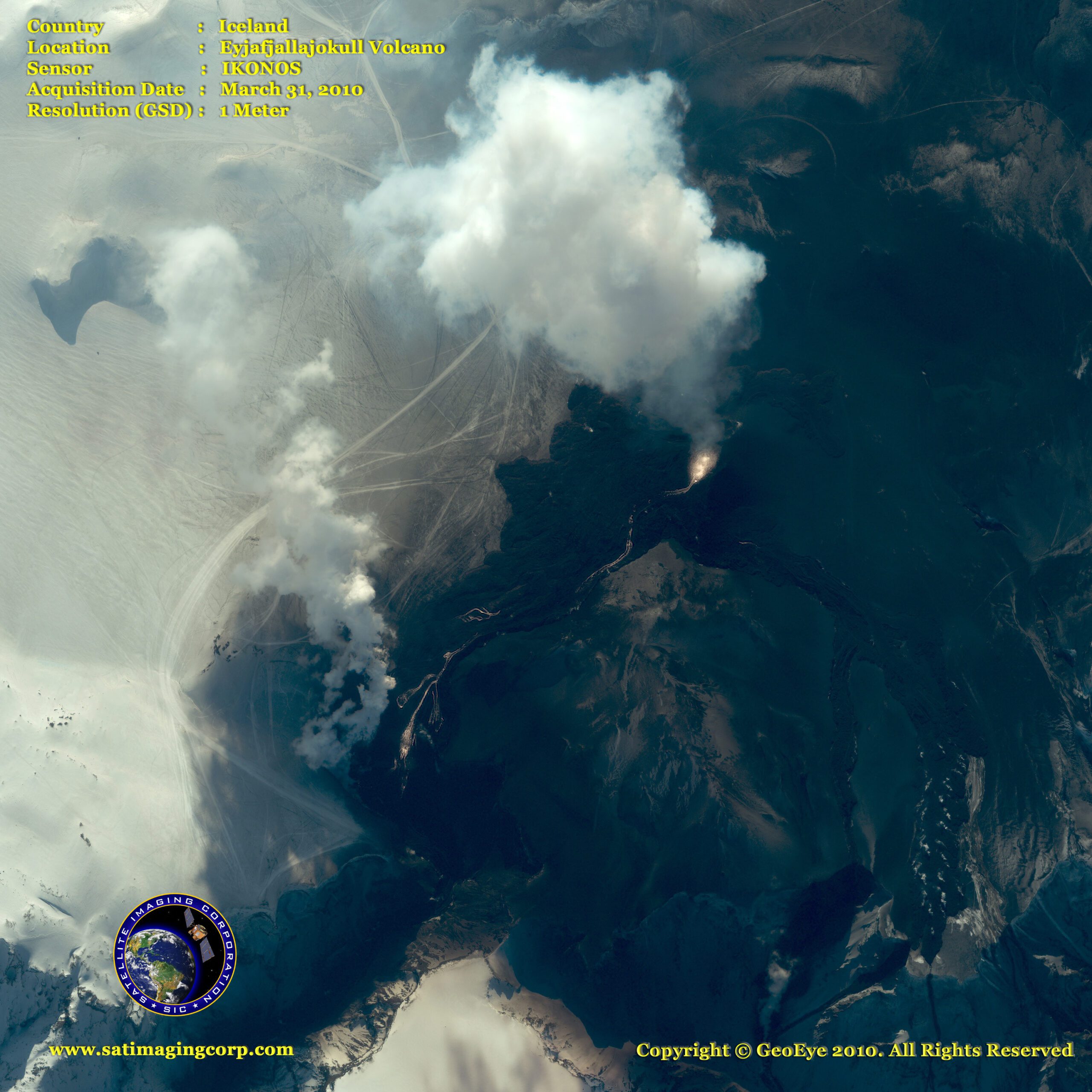
Image copyright © MAXAR – All rights reserved.