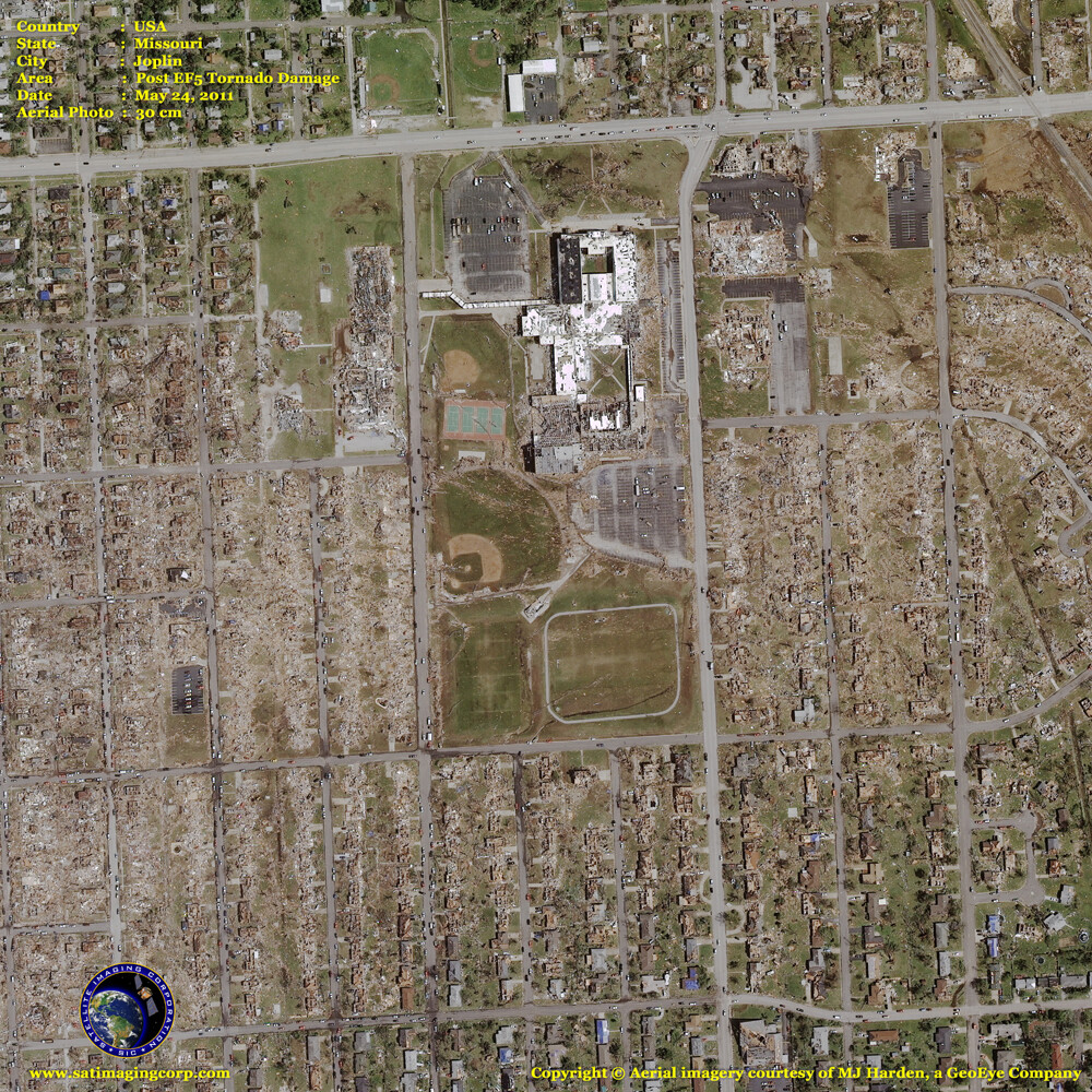
Aerial Photo Post EF5 Tornado Missouri
This aerial photograph captured the post damage of an Enhanced Fujita Scale (EF-5) tornado that hit Joplin, Missouri on May 22, 2011, one of many tornadoes and storms that wreaked havoc on the Midwest this month. The death toll has risen to 132 and possibly more have not been accounted for. There have been approximately 1,000 tornadoes in the US so far this year, according to the National Weather Service.
More than 500 people have been killed by twisters in 2011, making it the deadliest tornado year in the United States since 1953, according to the National Weather Service. The Joplin tornado was rated an EF-5, with winds in excess of 200 miles per hour.
Aerial photography in a geographic information systems (GIS) environment can give State and Emergency officials a wealth of information for the assessment, analysis, and monitoring of natural disasters such as hurricanes, tornadoes, and cyclone damage from small to large regions around the globe.
Aerial Photograph (30 cm) EF-5 Tornado Damage Joplin, Missouri
© Aerial Imagery Courtesy of MJ Harden


