
Satellite Image Tropical Cyclone Gonu
A satellite image captured Cyclone Gonu a category 5 on June 4, Gonu threatened the Arabian Sea and 1/5th of the World’s Oil. The cyclone tore through Oman and Iran causing 32 fatalities and 30 still missing, police said.
The last storm to hit was Cyclone 01A in May 2001. Gonu was the strongest storm to hit the Arabian Sea since 1945 with winds of 155 miles an hour was uncommon in the area, but not rare in the Northern Indian Basin, the storm caused panic and evacuation for the area towns and refineries in Oman causing oil prices to decline by Friday.
Tropical Cyclone Gonu (June 2007) – MODIS Satellite Sensor
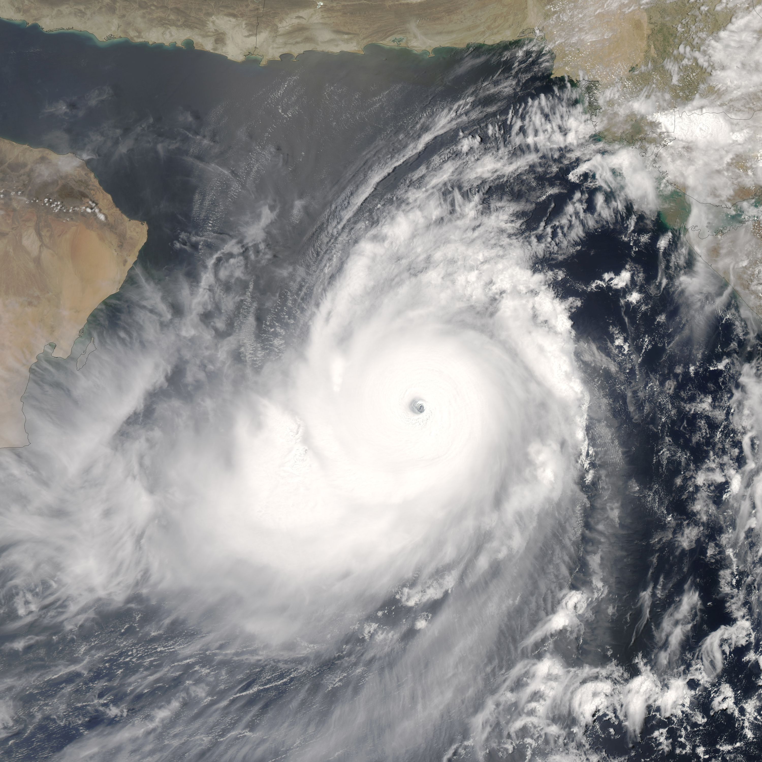
Image Credit: NASA
MODIS (or Moderate Resolution Imaging Spectroradiometer) is a key instrument aboard the Terra (EOS AM) and Aqua (EOS PM) satellites. Terra’s orbit around the Earth is timed so that it passes from north to south across the equator in the morning, while Aqua passes south to north over the equator in the afternoon. Terra MODIS and Aqua MODIS are viewing the entire Earth’s surface every 1 to 2 days, acquiring data in 36 spectral bands, or groups of wavelengths (see MODIS Technical Specifications). These data will improve our understanding of global dynamics and processes occurring on the land, in the oceans, and in the lower atmosphere. MODIS is playing a vital role in the development of validated, global, interactive Earth system models able to predict global change accurately enough to assist policymakers in making sound decisions concerning the protection of our environment.