
Satellite Images Coastal Erosion Alaska
USGS scientists recently completed a quantitative analysis which was published in the July 2007 issue of Geology, documenting 50 years of effects of accelerated and thermokarst lake expansion and drainage along a section of the Alaska North Slope coastline.
Landsat 7 – Alaska North Slope
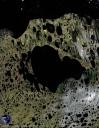
Image credit: USGS
The remote sensing analysis focused on the Beaufort Sea coast, located north of Teshekpuk Lake in the National Petroleum Reserve in Alaska. The data used in the analysis was taken in a time frame from 1955-2005. USGS scientists found that the rate of land loss attributed to coastal erosion more than doubled, from 0.48 km2 yr1 during 1955-1985 to 1.08 km2 yr1 during 1985-2005.
Importance of Natural Resources Issues
The low-lying Arctic coastal plain north of Teshekpuk Lake hosts endangered and threatened species of waterfowl is the calving grounds for large herds of caribou and contains potentially significant petroleum resources.
Given competing natural resource demands in this sensitive area, land, and resource managers are faced with the need to consider both the natural effects from a 30 years warming trend that has resulted in ice-pack shrinkage and deterioration of permafrost, as well as the potential impacts of proposed human activity.
QuickBird – Alaska North Slope

The results from this quantitative analysis contribute to an enhanced understanding of the dynamic and interactive processes that shape this landscape and provide information that is critically needed in sound land management and policy decision-making for sensitive Arctic areas.