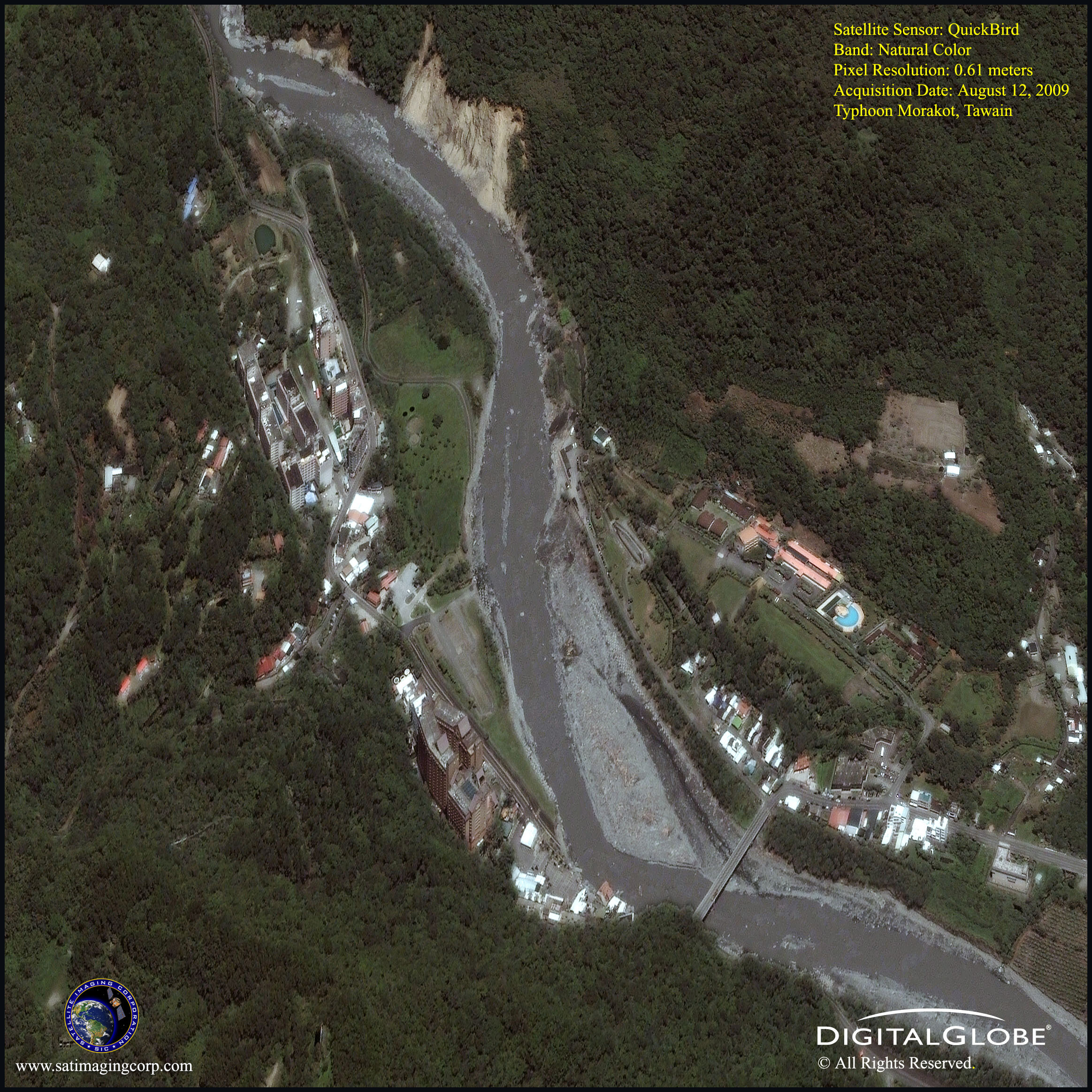
Satellite Maps Typhoon Morakot Taiwan
Typhoon Morakot claimed over 461 lives and many are still missing as it battered East Asia. Parts of the region experienced their worst flooding in half a century. A record 120 inches of rain fell during the weekend causing significant damage, at least 9.0 billion Taiwan dollars (281 million US) in agricultural damage another 570 million in Tourism, while 70,000 or more homes were left without power and 850,000 homes without water, according to officials.
These high-resolution QuickBird satellite images captured the unleashed flooding, mudslides, and destruction including the Chin Shuai Hotel in Chihpen, Taiwan.
Image copyright © MAXAR – All rights reserved.
Typhoon Morakot, Taiwan – QuickBird Satellite Image (0.61m)
Image copyright © MAXAR – All rights reserved.
Typhoon Morakot hit mainland China Sunday afternoon, where it claimed many lives as authorities ordered more than a million people to evacuate several provinces. In China, three and four-story apartment buildings collapsed and buried taking an unknown number of residents.
More than 8.8 million people in the three coastal provinces and in Anhui province as well were affected by Morakot, which forced local authorities to relocate 1.4 million.
The use of satellite images helps aid researchers to view natural disasters such as flooding, landslides, earthquakes, and hurricanes on both a local and a regional scale.
Disaster management and rescue organizations now widely use remote sensing and geographical information systems (GIS) when it comes to preparing, monitoring, investigating, and recovering from disasters like Typhoon Morakot.


