
Satellite Maps Disaster Recovery Samoa Islands
On Tuesday the 29th of September a devastating tsunami hit Samoa Islands after a massive earthquake measuring between 8.0 and 8.3 struck Lalomanu, Pago Pago, Samoa Islands, and Tonga a section of the Samoa Islands that is home to 65,000 people.
GeoEye-1 Satellite Image Pago Pago, Samoa Islands
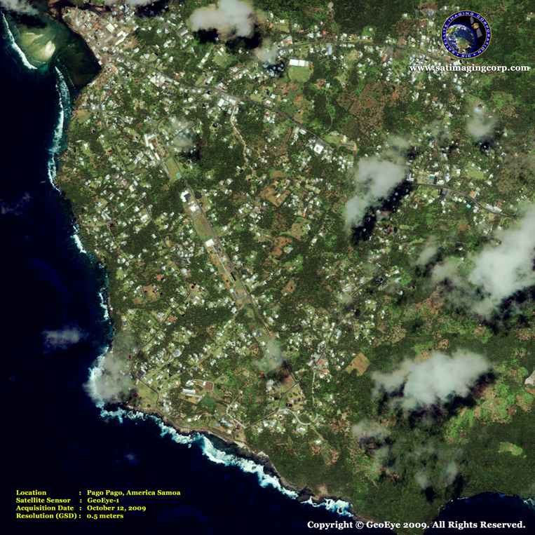
Image copyright © MAXAR – All rights reserved.
The death toll is expected to climb into the hundreds and many are still missing. Four tsunami waves 15 to 20 feet high hit American Samoa about 15 minutes after the quake, reaching up to a mile inland. The tsunami may have been destructive along coasts near the earthquake epicenter and could also have been a threat to more distant coasts.

Two color-coded perspective views of the Independent State of Samoa (left) and American Samoa (right), generated with digital elevation data from the Shuttle Radar Topography Mission, illustrate the varying topography of the islands.
Image Credit: NASA
About Samoa Islands
American Samoa is a group of six Polynesian islands in the South Pacific located between Hawaii and Australia. Fourteen degrees below the equator, it is the United States southernmost territory. It is known as the heart of Polynesia. If you drew a triangle from Hawaii, New Zealand, and Tahiti you would find Samoa in the middle. Western Samoa is a neighboring independent country that shares the same culture. American Samoa became an unorganized U.S. territory in 1900.