Satellite Maps Earthquake Damage Chile
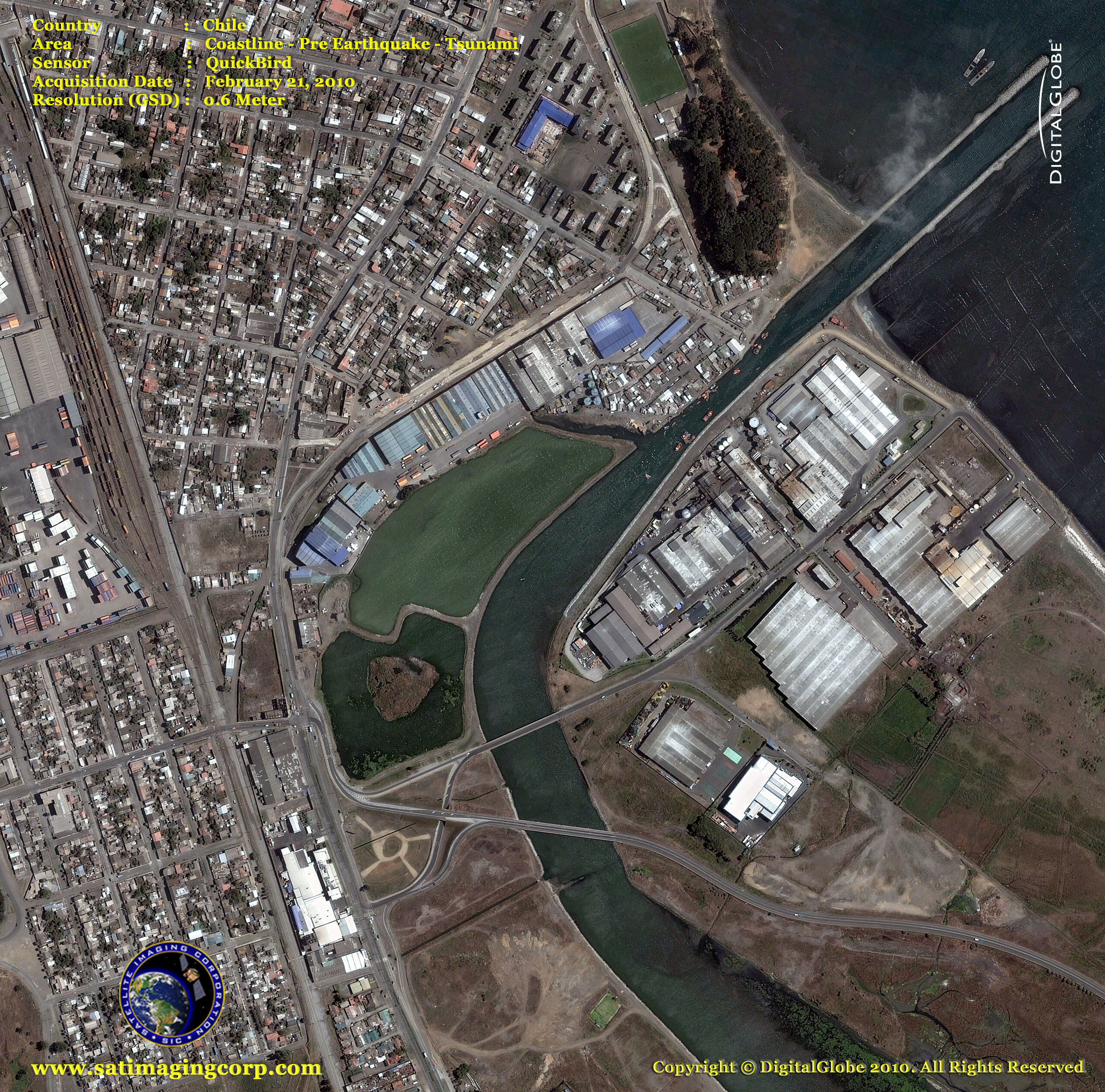
Satellite images captured the damage of the 8.8 magnitude earthquake and tsunami that hit Chile on February 27th. The earthquake was so sudden, people were shocked when it occurred. The intensity of the quake was so devastating that it caused blackouts in some areas of Santiago, Chile’s capital city.
QuickBird Satellite Image (0.6m) – Pre-Earthquake/Tsunami Chile – Coastline
Image copyright © MAXAR – All rights reserved.
QuickBird Satellite Image (0.6m) – Post Earthquake/Tsunami Chile – Coastline
Image copyright © MAXAR – All rights reserved.
Reports of hundreds of bodies have been found and possibly more will be discovered. Police and military troops are posted on street corners to prevent looting and chaos. Many of the city’s 500,000 inhabitants are short of food, water, and electricity was cut off.
Military helicopters carrying relief supplies landed Tuesday in the coastal town of Concepcion, which was in ruins following the 8.8 magnitude quake and tsunami. A makeshift morgue was established in a gymnasium, where bodies lay on the floor for identification, and the names of the dead were posted outside.
Earthquake Altered Earth’s Axis
The earthquake was so powerful that it likely shifted Earth’s axis and shortened the length of a day, NASA announced Monday.
By speeding up Earth’s rotation, the magnitude 8.8 earthquake shortened an Earth day by 1.26 millionths of a second, according to new computer-model calculations by geophysicist Richard Gross of NASA’s Jet Propulsion Laboratory in California.
Gross also estimates that the earthquake shifted Earth’s figure axis by about three inches (eight centimeters).


