Satellite Image Mississippi River Flooding
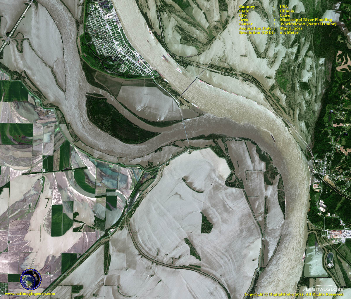
These high-resolution WorldView-2 satellite images show the devastating floods of the Mississippi River in the Midwest hitting Arkansas to Tennessee and Mississippi to Louisiana. Swollen by weeks of heavy rain and snowmelt, the Mississippi River has been breaking high water records that have stood since the 1920s and ’30s. It is projected to crest at Vicksburg on May 19 and shatter the mark set there during the catastrophic flood in 1927. The river is expected to crest at 57.5 feet on May 19, about 1.5 feet above the 1927 record, according to the U.S. Corps of Engineers.
The City of Natchez is expected to flood on May 21 with New Orleans to follow on May 23. Damage in Baton Rouge and New Orleans could be lessened if the U.S. Corps of Engineers opens the Morganza spillway to relieve pressure on levees but it would flood thousands of acres of farmland and thousands of homes.
WorldView-2 (Natural Color) Satellite Image Flooding
Image copyright © MAXAR. All Rights Reserved
WorldView-2 (False Color) Satellite Image Flooding
Image copyright © MAXAR. All Rights Reserved


